
Imagine flying over the Amazon rainforest, looking down at an endless green carpet of trees. Somewhere beneath that canopy might be an ancient city, complete with roads, plazas and houses. But from the air, there is nothing to see. Just leaves. Millions upon millions of leaves. Now imagine pressing a button and making all those trees disappear.
That is the extraordinary trick of lidar, a technology that National Geographic explorer Albert Lin helped bring to millions of television viewers through series such as Lost Cities with Albert Lin and Lost Cities Revealed. Armed with laser scanners, three-dimensional maps and a taste for adventure, Lin showed audiences how archaeologists could reveal traces of civilizations concealed by jungles for centuries.
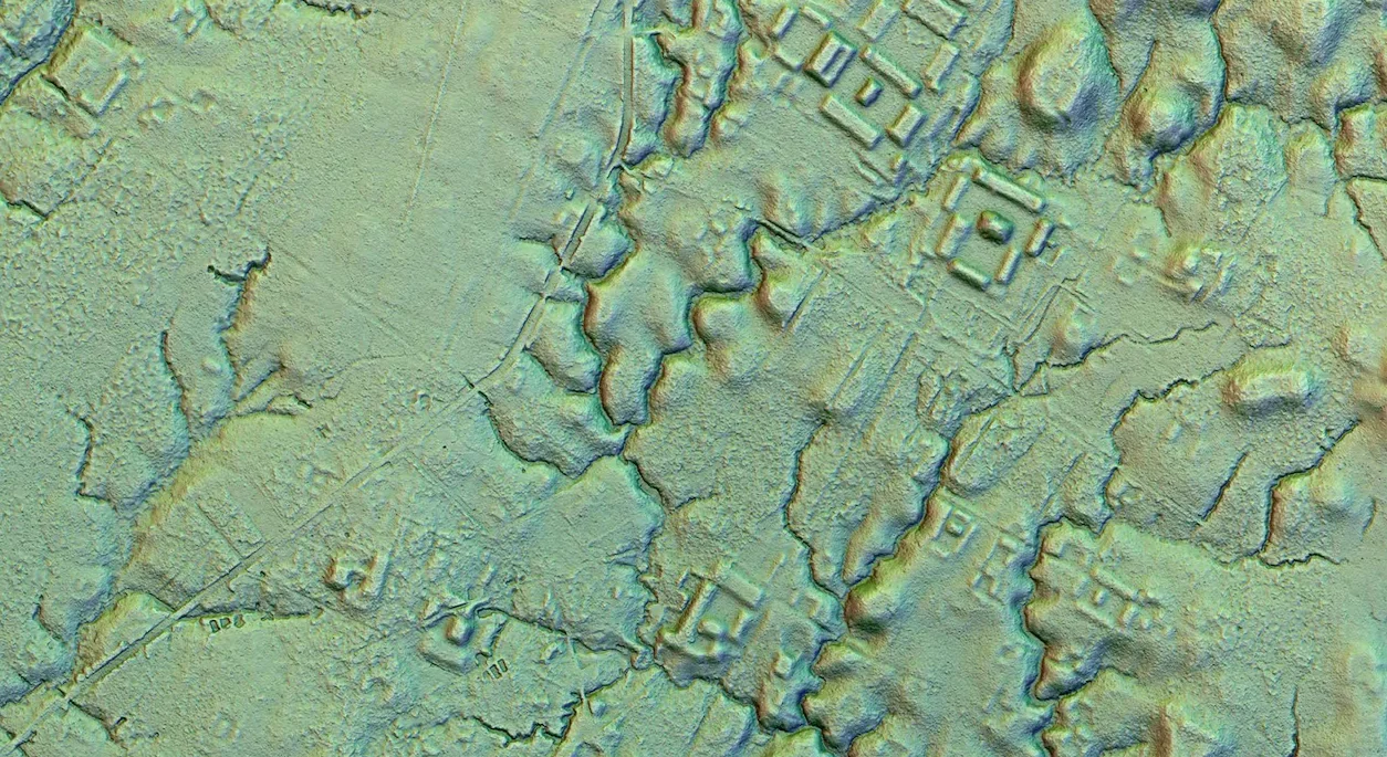
And the discoveries were astonishing. In the Amazon, scientific teams using lidar uncovered sprawling networks of ancient settlements, roads, canals and ceremonial platforms. A 2022 survey in Bolivia revealed an elaborate landscape of towns and monumental structures built by the Casarabe culture. In 2024, researchers described a vast network of settlements in Ecuador's Upano Valley, where thousands of earthen platforms were linked by remarkably straight roads.
These were not discoveries made by Lin himself. They were the work of archaeological teams, building on years of research and, in some cases, knowledge already held by local communities. But Lin's television adventures helped make the technology behind such discoveries famous. The idea was irresistible: an entire forgotten landscape could be hiding in plain sight, waiting for someone to remove the trees from a computer screen.
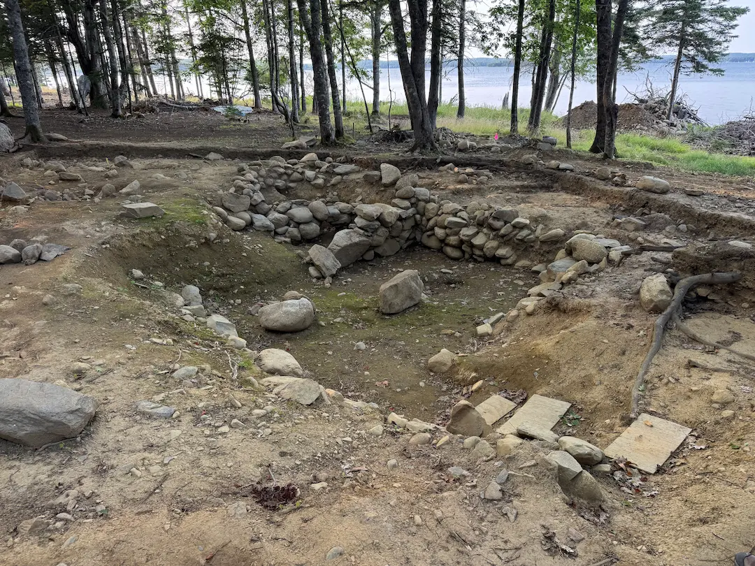
And if lidar could reveal ancient roads in the Amazon, could it find a forgotten road on Oak Island? In 2026, the treasure hunters decided to find out. A laser scanner was carried through the woods on the island's western side, and when the trees were digitally removed, a curious line appeared. It began near the buried stone foundations of Lot 5, crossed Lots 6 and 7, and pointed almost directly toward a giant boulder on Lot 8. Nobody had recognized the complete route while walking through the woods, yet there it was on the computer.
"There appears to be a path," said lidar expert Pete Kelsey as he showed the results to Rick and Marty Lagina's team. It was an exciting discovery, but was it really an old road? And could lidar tell them who had built it?
 Lot 5 Stone Feature→
 Large Boulder→
How to Make a Forest Disappear
2 min
Lidar sounds like something from a science-fiction film, but the basic idea is surprisingly simple. Its name stands for Light Detection and Ranging, and it works a little like radar, except that it uses laser light instead of radio waves. Picture standing in a dark room with a flashlight. You point it at a wall and see the light bounce back. Now imagine you could measure exactly how long that light took to return. Because light travels at a known speed, you could calculate how far away the wall was.
That is essentially what lidar does, only much faster and with extraordinary precision. A lidar scanner fires hundreds of thousands of tiny laser pulses into its surroundings. Some bounce off nearby branches, others off rocks, buildings or the ground. A sensor records the returning light, calculates the distance to each reflection and assigns it a position in space. Do this enough times and you create a three-dimensional cloud of millions of measured points, which a computer can turn into an astonishingly detailed model of the landscape.
Here comes the clever part. When a lidar-equipped aircraft flies above a forest, many laser pulses hit the tops of the trees. Others find gaps between leaves and branches, reaching lower vegetation or the ground itself. A single patch of forest might therefore produce measurements from several different heights. Computer software sorts through these measurements, identifying which points probably belong to the ground and which belong to trees and other objects. The vegetation can then be hidden from the model, leaving a digital picture of the terrain underneath.
The laser is not magically seeing through solid tree trunks or thick earth. It is measuring surfaces it can reach, often through tiny gaps in the canopy, and software reconstructs the ground from those measurements. In a dense forest, an ancient road may have become nothing more than a shallow depression. A defensive wall might survive as a low bank, while the outlines of a settlement might consist of barely noticeable bumps and ditches. Almost impossible to recognize while standing among the trees, these features can suddenly become obvious when the vegetation is removed digitally and the terrain is viewed from above.
That is what makes lidar such a powerful tool for archaeology. A series of seemingly random bumps might reveal the outline of a building. Several shallow depressions might turn out to form a road. In the Amazon, entire networks of settlements have emerged from landscapes that previously looked like uninterrupted jungle. The technology doesn't tell archaeologists what those features mean, but it gives them a remarkably detailed map of where to investigate.
Oak Island's Laser Scanner Under the Trees
1 min
On Oak Island, the 2026 survey used a slightly different approach from the airborne scans that had transformed archaeology in the Amazon. Rather than flying above the forest, the team brought the scanner into it. Rick and Marty Lagina, who lead the search for Oak Island's supposed treasure, and their partner Craig Tester had commissioned a survey of Lots 5 through 8 using a technology called SLAM lidar. "It's on the ground," Craig explained. "It's not up in a drone."
SLAM stands for Simultaneous Localization and Mapping. The name is complicated, but the idea is useful: the scanner builds a map while simultaneously working out where it is within that map. Think of someone walking through an unfamiliar house, continuously measuring the distance to every wall, doorway and piece of furniture. By comparing each new measurement with the previous ones, a computer can gradually reconstruct both the house and the route taken through it. A SLAM lidar scanner does something similar as its operator moves through the woods.
The Oak Island instrument collected around 300,000 points every second. Because it travelled below the tree canopy, it could record the forest floor and surrounding objects from close range, rather than relying entirely on laser pulses making their way through the leaves from above. It was a particularly interesting choice for the western lots, where the team was trying to identify faint changes in the ground between known stone features.
The man carrying out the survey, Pete Kelsey, was no stranger to unusual places. Originally trained in land surveying, Kelsey had worked on three-dimensional documentation projects involving Alcatraz, the famous prison island in San Francisco Bay; the enormous stone moai of Easter Island; and the wreck of the USS Arizona at Pearl Harbor. Now he was looking for something rather less dramatic to the naked eye: a possible path through a Nova Scotia forest.
A Mysterious Line Across Four Lots
2 min
Kelsey presented his results in the War Room in Season 14, Episode 2, “Bubbling Up”, which aired in November 2026. First came Lot 5, already one of the island's most intriguing archaeological locations. The team had been investigating buried stone foundations there, including features that had raised questions about what might once have stood on the site. When Kelsey displayed the lidar model with the trees removed, several details became easier to recognize.
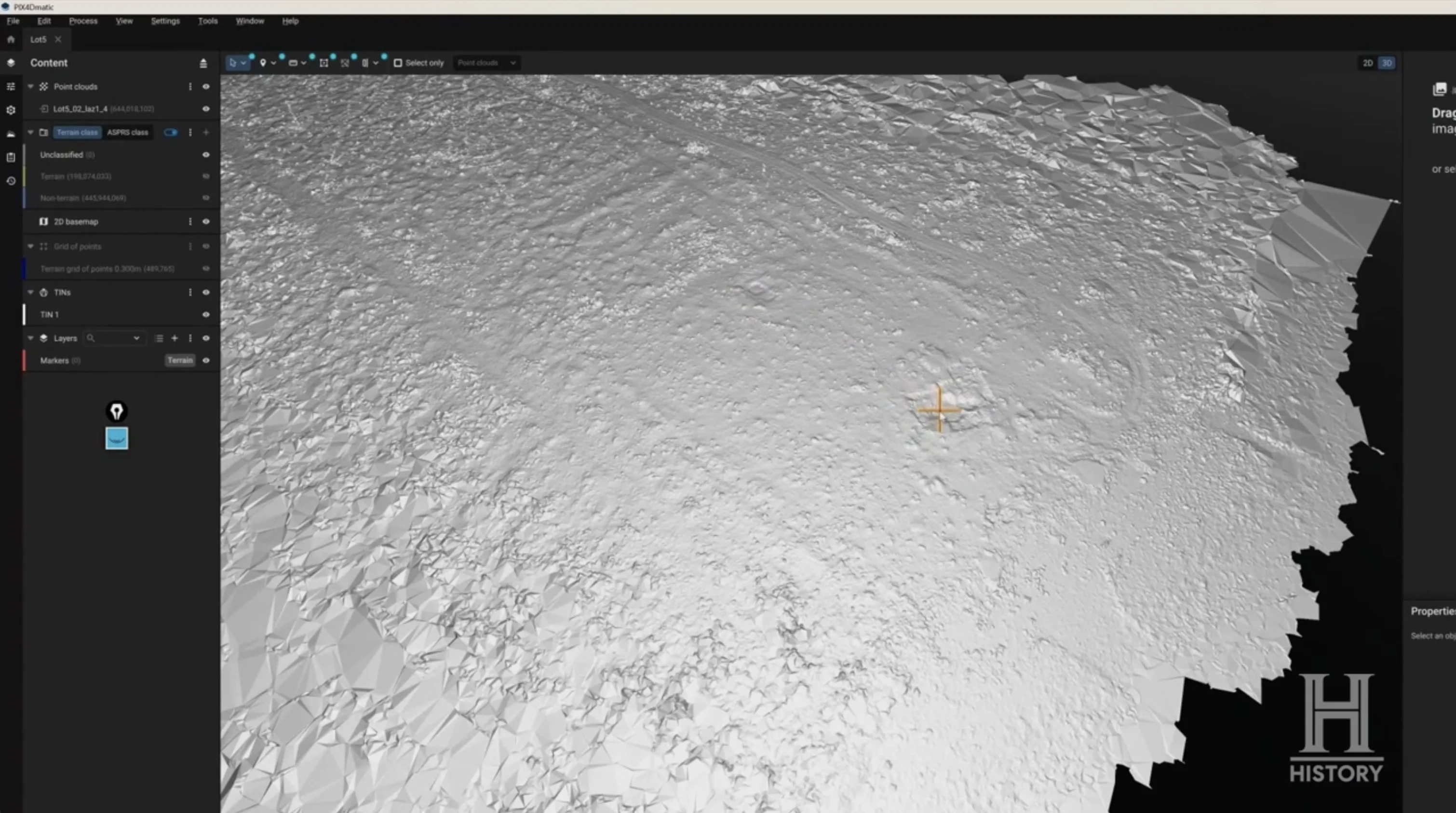
There was a broad arc in the landscape and a deep ditch cutting across it. To Kelsey, the ditch did not look like an ordinary drainage feature produced by nature. Its shape suggested that people might have worked the ground. Then he pointed out something else: what appeared to be a path passing near the middle of Lot 5. On its own, it might not have seemed especially exciting. Old properties are full of tracks, banks and ditches, particularly on an island that was farmed for generations. But the neighboring lots held more clues.
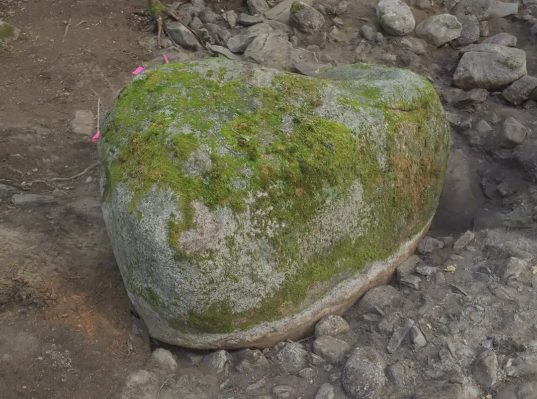
On Lot 6, a low bank appeared to continue a feature seen on Lot 5. On Lot 7, another linear feature extended from the end of one of two stone walls the team already knew about. And on Lot 8, the model showed another possible section of pathway, along with the former position of the enormous 40,000-pound boulder the team had lifted. Individually, these were just shapes on a map, but surveyor Steve Guptill began putting them together.
When Guptill connected the possible sections across the four lots, they appeared to form one long route, beginning around the archaeological remains on Lot 5 and running almost straight toward the great boulder on Lot 8. Had someone once deliberately connected the two places? Had carts or workers travelled between them? Or was the apparent alignment simply a collection of unrelated landscape features? Lidar had given the team a new question, but it had not yet supplied the answer.
 Oak Island's Lot 5: From Stone Circle to Buried Complex→
Oak Island Had Already Been Scanned From the Air
1 min
Anyone wondering why the team had not tried lidar earlier might be surprised to learn that they had. In fact, the island had been scanned years before the 2026 discovery, and some of the resulting data had been publicly available for almost a decade. Back in 2016, an aircraft carrying a lidar instrument from the Centre of Geographic Sciences, or COGS, flew over Oak Island. The college, part of the Nova Scotia Community College system, used a specialized survey method capable of mapping both dry land and shallow coastal water.
This type of instrument, known as bathymetric lidar, uses laser measurements to record shallow underwater terrain where conditions permit, as well as the land surface. It is particularly useful near shorelines, where water can be too shallow for conventional survey boats. Long before Kelsey walked among the trees, researchers had therefore already created a digital elevation model of Oak Island and parts of its surrounding shoreline.
The province of Nova Scotia made the 2016 lidar data available free of charge. Anyone interested enough could download it and explore the island's terrain. Oak Island Tours, the company behind the treasure search, even directed people who wrote in suggesting lidar toward that existing public dataset. There is another interesting connection: Steve Guptill, the surveyor who would eventually recognize the possible route between Lots 5 and 8, had studied and worked at COGS.
The technology was therefore not new to Oak Island. What changed over the years was the equipment, the detail available for particular locations and, perhaps most importantly, the questions people asked of the maps.
 Centre of Geographic Sciences (COGS)→
One Laser Map, Two Very Different Stories
2 min
Here is where things get especially interesting. A treasure hunter and an archaeologist can look at exactly the same lidar map and come away with completely different ideas about what it shows. In November 2018, Jonathan Fowler, an archaeologist at Saint Mary's University in Halifax, downloaded the public elevation data for Oak Island, joined two map tiles together and took a careful look.
Fowler was open about the disagreement surrounding the island. Most professional archaeologists, he wrote, regarded the famous treasure story as bogus, while the treasure hunters believed the archaeological establishment had overlooked important evidence. So what did he see when he examined the laser map? Not the outlines of a mysterious underground civilization or a hidden network of treasure routes. He saw a farming landscape.
First, the wider geography. Oak Island lies among drumlins, hills formed by glaciers that left behind some of the better agricultural soils along this stretch of the Nova Scotia coast. Then came the evidence of human activity. "Oak Island itself was once thoroughly ploughed," Fowler wrote. Many of the long, straight features visible in the elevation data were consistent with old field boundaries and stone piles. Farmers had cleared rocks from their fields and deposited them along property lines, beginning with New England settlers in the 1760s and continuing through the nineteenth century.
Those apparently mysterious lines therefore had a perfectly ordinary possible explanation: people had been trying to grow crops. At the eastern end of the island, Fowler saw something else unmistakably human. The Money Pit area was covered in the scars of generations of treasure hunting: excavations, flattened ground and disturbed terrain. In the lidar data, the area around the pit appeared as a levelled work pad roughly 28 feet above the waterline.
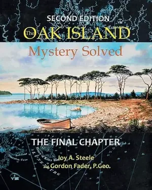
His map later appeared in Oak Island Mystery: Solved, by Joy Steele and marine geologist Gordon Fader. Steele and Fader also examined features such as the long trench excavated by veteran treasure hunter Fred Nolan and the cofferdam at Smith's Cove. They interpreted various mounds and hollows around the island as evidence of natural sinkholes, old tar kilns and other historical activity. To them, the lidar map told a story of geology, agriculture and industry rather than buried treasure.
And this illustrates something important about the technology. Lidar is extremely good at showing what shape the ground has. It is not nearly as good at telling you why the ground has that shape. A straight bank might be the edge of an old road, a farm boundary or the remains of an earthwork. The scanner records the bank; a human being still has to figure out what it means.
Before the Forest, There Was a Mysterious Stone
1 min
The television team had also experimented with laser scanning, but its first notable use on the show was not to map an entire forest. It was to investigate a stone. In Season 6, filmed in 2018, the team examined a slab found in the basement of a former bookbindery in Halifax. They suspected it might be connected to the legendary 90 Foot Stone, supposedly discovered deep in the original Money Pit and said to have carried a mysterious inscription. If the stone really had once been engraved, perhaps some trace of its markings survived.
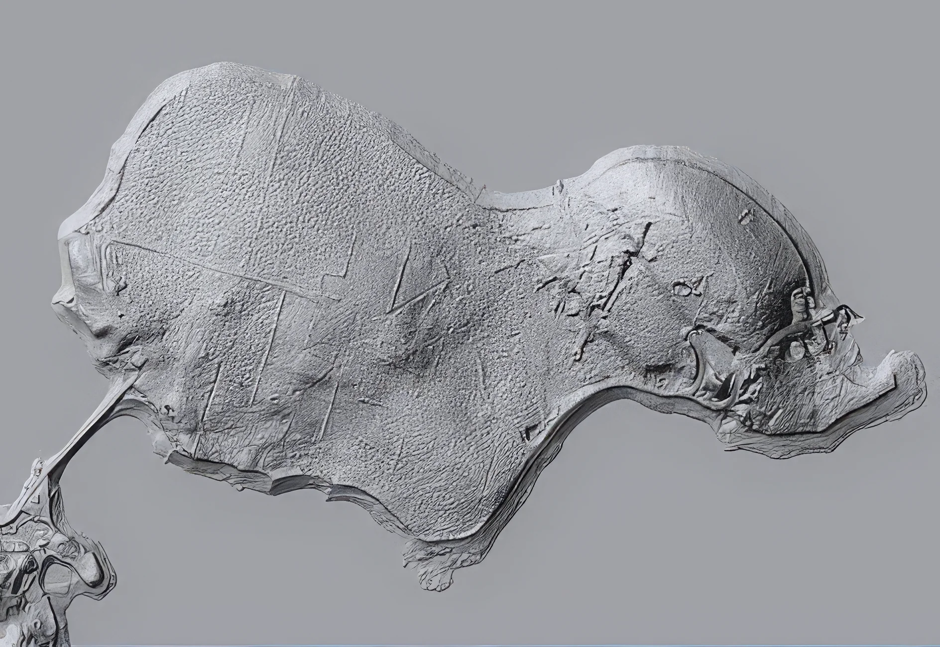
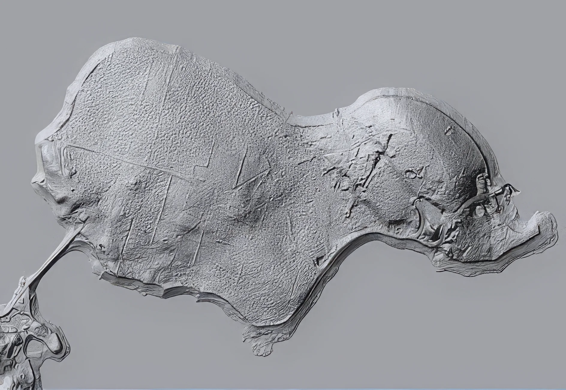
Archaeologist Laird Niven suggested scanning its surface in three dimensions. Azimuth Consulting of Halifax carried out the work, recording the stone's minute changes in height. The resulting model revealed the letters LN on one side and a faint A. It was a useful demonstration of another application of laser scanning. Rather than searching for large features hidden beneath trees, the team was looking for tiny irregularities in a single object's surface. Even shallow scratches or worn markings can sometimes become easier to examine when a three-dimensional scan is viewed under different virtual lighting conditions.
The team also scanned a second stone found near the Money Pit, dusting it with talcum powder to improve the scanner's ability to record the surface. There is one other distinction worth making. During the same season, marine students from the college surveyed the seabed south of Oak Island's swamp. That work is sometimes remembered as lidar, but the college described it as sonar.
Sonar uses sound waves rather than laser light. It is especially useful underwater, where acoustic signals can travel considerable distances. The marine survey identified two possible vents in the seabed south of the swamp, an area where longtime treasure hunter Dan Blankenship had reported seeing holes in the winter ice in 1980. Different technologies, different measurements, but the same basic goal: finding something that ordinary observation had missed.
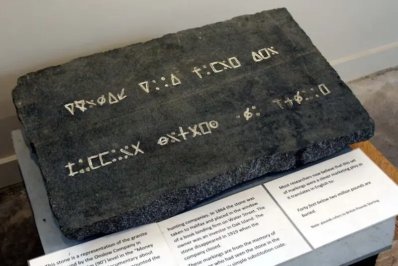 Inscribed stone (90-foot stone)→
A Drone Found a Giant Rectangle on Lot 30
1 min
By Season 10, filmed in 2022, the search had moved back to the landscape itself. This time, Phoenix Aerial Productions brought a lidar-equipped drone to Oak Island for a survey covering the whole island. The flights began around Lot 32, beside the swamp, and Rick Lagina was particularly interested in whether the equipment could identify an old road. Instead, one of the most intriguing results appeared on Lot 30.
When geoscientist Dr. Ian Spooner and surveyor Steve Guptill examined the data, they noticed a remarkably regular rectangular feature measuring approximately 100 by 150 feet. Nature can produce some surprisingly geometric shapes, but this one looked sufficiently unusual to deserve a closer look. Could it be the footprint of a former structure? A deliberately altered piece of ground? Or something entirely different?
Once again, lidar could not answer those questions on its own. Laird Niven recommended opening small exploratory trenches by hand before considering larger excavations. The archaeologists then laid out test pits to examine the feature. That is how lidar is supposed to work in archaeology: the scanner identifies an anomaly, and the archaeologists investigate it. Only by examining the soil, structures and any associated artifacts can they begin to determine what actually produced the shape.
By 2026, the team was ready to apply the same approach to the newly identified line across Lots 5 through 8.
Walking The Line
2 min
The day after Kelsey presented his findings, Steve Guptill led Rick and Marty Lagina and metal-detection expert Gary Drayton into the woods on Lot 5. On the computer, the line looked intriguing. But what would it look like when they actually stood on it? "I think you can almost see this path," Marty said. That was precisely the problem lidar had helped overcome. A shallow feature that is difficult to recognize among leaves, roots and uneven ground can become much clearer when its surrounding terrain is mapped and viewed as a whole.
Marty wanted something more convincing than a line on a screen. He hoped the team would find objects that supported the idea of a path and, ideally, helped establish when it might have been used. Gary soon picked up a signal. The first object was a button with one large loop on the back. Gary explained that the size of the loop was characteristic of older button styles and suggested a date somewhere between 1750 and 1850. It was an interesting find, although a button alone could not prove the existence of a road. People lose clothing fasteners while farming, cutting timber, working or simply walking across a property.
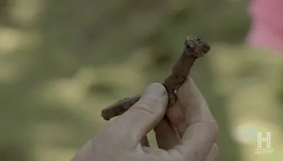
Then came something heavier. A little farther along the possible route, the metal detector located a substantial iron spike buried deep in the ground. It had a square shank and might have been a rosehead spike, a type of hand-forged fastener used in heavy timber structures, including mine shafts, from the sixteenth to the early eighteenth century. Gary wondered how such an object had ended up there. Why would a large iron spike be lying "out here in the middle of nowhere"? One possibility, he suggested, was that it had fallen from a cart travelling through the woods.
For Rick, the find strengthened the idea that something might once have moved along the route between Lots 5 and 8. There was now a possible pathway, a button near one end, a substantial iron spike farther along and an enormous boulder at the other. The pieces were intriguing, but they were not yet proof that all these objects belonged to the same period or activity.
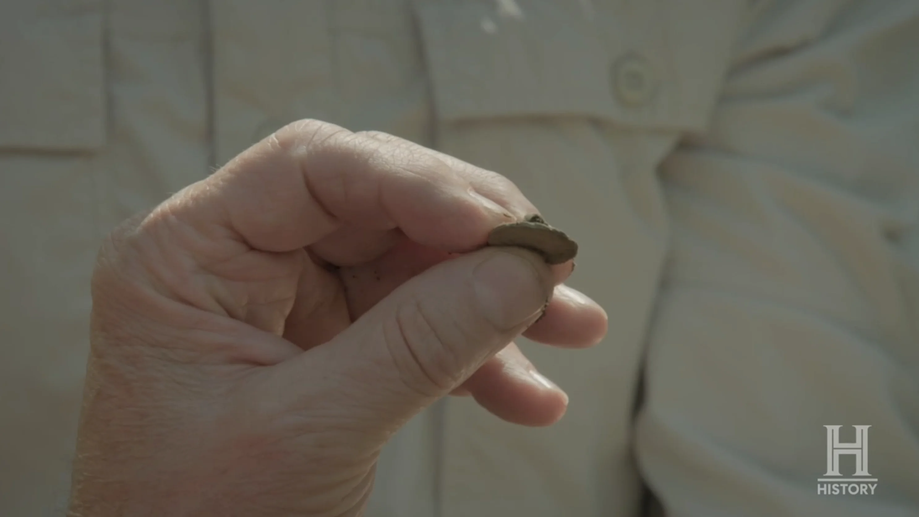 Single-loop button (Lot 5 pathway)→
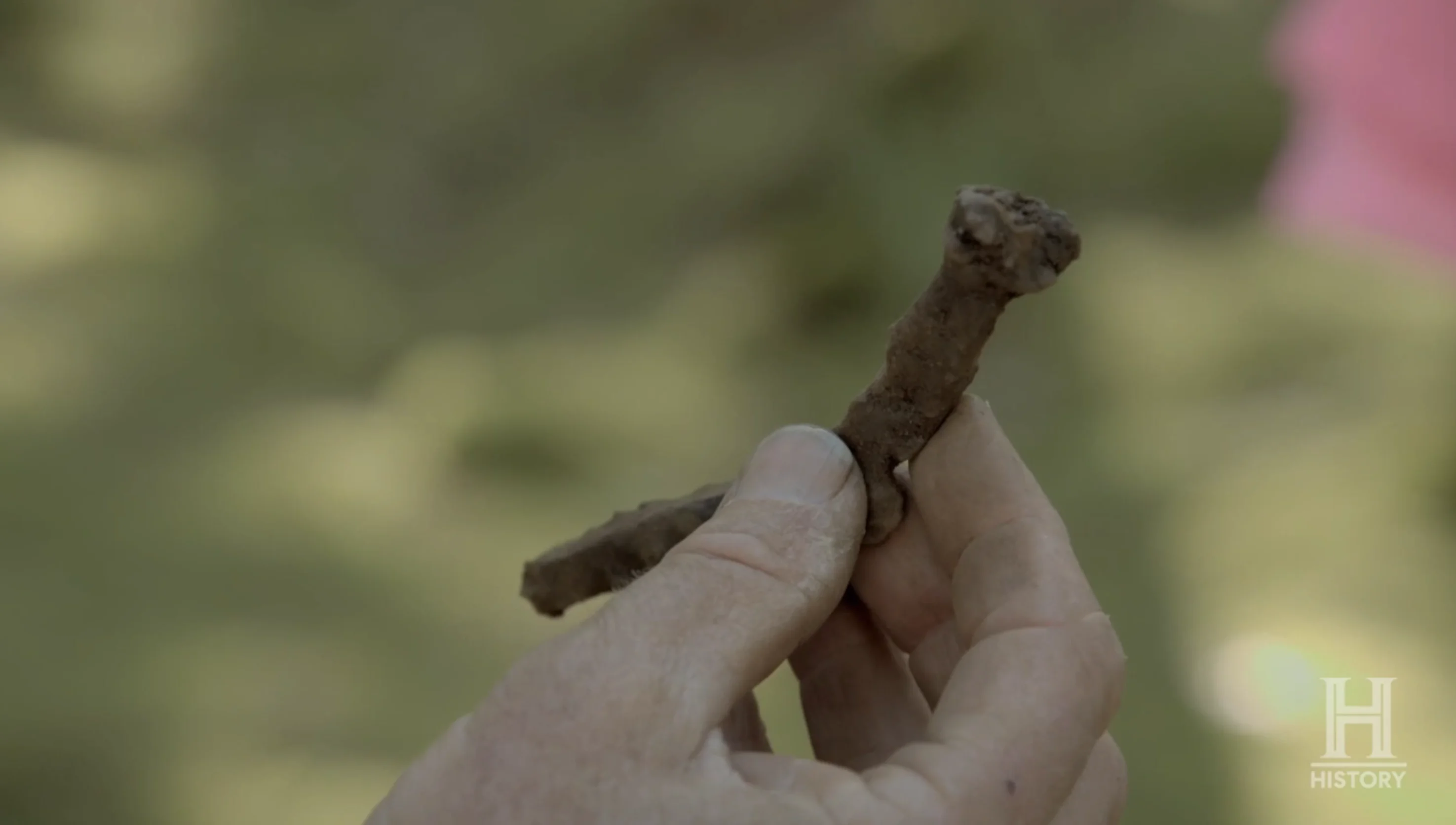 Possible rosehead spike (Lot 5 pathway)→
Lidar Doesn't See Everything
1 min
After watching Albert Lin reveal extraordinary ancient landscapes on television, it is tempting to imagine lidar as a kind of archaeological X-ray machine. Point it at a jungle, and ancient cities appear. Point it at Oak Island, and perhaps the Money Pit, hidden tunnels and buried treasure chambers will reveal themselves. Unfortunately, that is not how it works.
The lidar systems used to map terrain measure visible surfaces. They cannot look through solid rock, identify a chamber deep underground or follow a buried tunnel beneath the Money Pit. To investigate those kinds of underground targets, the Oak Island team has turned to other techniques, including seismic surveys, muon tomography and drilling.
Nor can lidar tell how old something is. A ditch dug in 1650 and a ditch dug in 1850 may look almost identical on a terrain model. A road used by settlers could resemble an older route. An earth bank associated with farming might look like the edge of a much more mysterious construction. And that limitation matters particularly on Oak Island, where centuries of agriculture, timber cutting, construction and treasure hunting have repeatedly altered the landscape.
Even the Amazon discoveries that made lidar so famous require archaeologists to examine the sites on the ground. The scans reveal the shapes of potential buildings and roads, but excavation, dating and historical research are needed to understand who made them and when. In fact, lidar's real revolution is not that it eliminates the need for archaeology. It tells archaeologists where to concentrate their efforts.
Did the Lasers Solve Anything on Oak Island?
1 min
Not the treasure mystery. But they did change the way the island could be investigated. In 2016, an airborne survey produced a detailed elevation map that anyone could study. Jonathan Fowler used it to reconstruct a landscape shaped by farming and generations of human activity. In 2018, laser scanning helped examine the surface of a mysterious stone. In 2022, a drone survey drew attention to a large rectangle on Lot 30. And in 2026, a scanner carried through the western woods identified a possible route linking archaeological features across four lots.
The most interesting part is how differently the same kind of evidence can be interpreted. Fowler looked at Oak Island's landscape and saw old agricultural boundaries. Steele and Fader identified natural and industrial features. The Laginas' team saw a possible connection between two locations they were already investigating. All of them were looking at marks on the ground left by the island's past. The disagreement was over what those marks meant.
That brings us back to the Amazon. Lidar did not create the ancient settlements there, and it did not turn every mound into a lost city. It simply made large patterns in a difficult landscape visible in extraordinary detail. On Oak Island, the transformation was smaller, but the principle was exactly the same. A stretch of woods that had looked like nothing more than trees, rocks and uneven ground became a map with a possible line running through it.
At one end were the stone features of Lot 5. Along the way were a button and an iron spike. At the other end stood the site of a 40,000-pound boulder. Whether those things were historically connected remained an open question. But after more than two centuries of digging on Oak Island, the team had found another way to search its past: not by looking deeper underground, but by taking a much better look at the surface.
Sources
1 min
Books
- Joy A. Steele and Gordon Fader, Oak Island Mystery: Solved: The Final Chapter, 2nd edition (2018), chapter 13
Articles and television
- Jonathan Fowler, "Lasers Over Oak Island" (4 November 2018)
- Nova Scotia Community College, "Hunting for treasure" (2019), on the Centre of Geographic Sciences surveys of Oak Island
- Geo Week, speaker biography of Pete Kelsey
- National Geographic, Lost Cities with Albert Lin and Lost Cities Revealed with Albert Lin
- University of California San Diego, "Behind the Scenes with National Geographic Explorer Albert Lin" (19 December 2023)
- Research on the Casarabe culture and lidar mapping in the Bolivian Amazon, Nature (2022)
- Research on ancient settlement networks in Ecuador's Upano Valley, Science (2024)
Survey data
- Province of Nova Scotia, lidar elevation data for Oak Island (2016), Elevation Explorer
- Natural Resources Canada, High Resolution Digital Elevation Model (HRDEM)