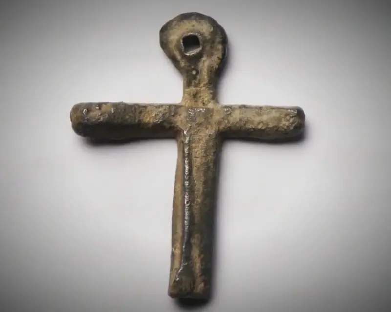
A small lead cross recovered on Oak Island in 2017, dated to between 900 and 1300 AD, was traced by lead isotope analysis to medieval ore deposits in southern France. Its date and its origin place a worked European object on the island during the period of the Knights Templar, the most powerful military order of the medieval world. The cross is one of several finds that have drawn the island into the Templar question, and it is the place to begin.
 Lead cross→
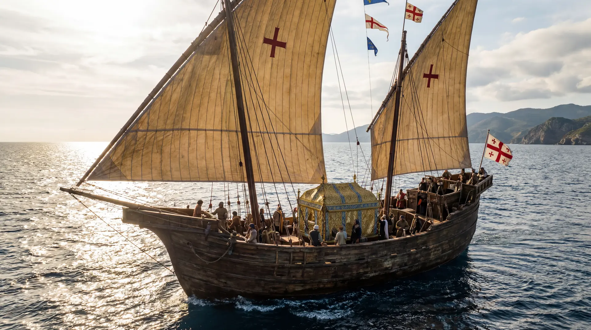
The Knights Templar, or the Poor Fellow-Soldiers of Christ and of the Temple of Solomon, were a military religious order founded in Jerusalem around 1119 AD. A small group of knights led by Hugh de Payns, a nobleman from the French province of Champagne, pledged to protect Christian pilgrims on the dangerous roads between the port of Jaffa and Jerusalem. King Baldwin II granted them quarters in the al-Aqsa Mosque on Temple Mount, the former site of Solomon's Temple, and it was from this location that they took their name. For the first decade they numbered fewer than twenty. Then, in 1129, Bernard of Clairvaux, the most influential churchman in Europe and an uncle to one of the original knights, secured papal recognition for the order at the Council of Troyes. Bernard wrote their Rule and solved the theological problem that had troubled Christendom: whether a devout monk could also be a warrior. His answer, set out in In Praise of the New Knighthood, was that holy killing was a duty rather than a sin. Donations of land, property, and wealth followed from across Europe. By 1139, Pope Innocent II had issued the bull Omne Datum Optimum, exempting the Templars from all taxes, freeing them from local authority, and placing them under the direct protection of the Holy See. Within thirty years of their founding they had become bankers, shipbuilders, landlords, and the administrators of thousands of properties organized into nine provinces stretching from Portugal to the Levant. They maintained a fleet capable of crossing the Mediterranean, and the records confirm they transported relics across long distances by sea, including, in 1254, holy relics shipped from the Crusader port of Acre to southern France aboard the vessel Montjoie. No organization in the medieval world, apart from the Catholic Church itself, operated on this scale.
 Sacred Cargo, Relics crossing Oceans→
By the early thirteenth century the order stood at the height of its power and its organizational reach. The same decades saw the great Gothic cathedrals rise across France, dozens under construction at once, much of it co-financed by the Temple and built with the mathematics and masonry the crusades had carried back from the East. The 1220s were the pinnacle of that building, and of the order's strength behind it.
Ruad, the last island
1 min
For nearly two centuries the order had only grown, but in 1291 the tide turned. Their last stronghold in the Holy Land fell, and with it the last Crusader holdings on the Levantine mainland. The loss took away their purpose in the East and forced them to withdraw to Cyprus. Ruad, a small island fortress off the Syrian coast near Tortosa, became the closest foothold left with a view of the Holy Land, garrisoned around 1300 by roughly a hundred and twenty Templars awaiting a Mongol alliance that never came.
Among that garrison was a Templar called Gérard de Villiers. When the Mamluks besieged Ruad in 1302 the Templars were starved out; a free passage was negotiated and then betrayed, and the men were massacred or enslaved as they emerged. De Villiers was not among them. The knight Ponsard de Gizy testified at the Paris trials in November 1309 that de Villiers had "left a day earlier, taking his friends with him," before the siege closed. Five years later the same man would leave Paris with fifty horses on the eve of the arrests. Twice he was out of a fortress before the door shut, which points to a man with intelligence of his own and the standing to act on it.
The End of the Temple
3 min
On October 13, 1307, the next and final blow was dealt to the Order when King Philip IV of France ordered the arrest of every Templar in the country. The leadership had warning. In testimony before the Papal Inquisition at Poitiers in June 1308, the knight Jean de Châlons, Preceptor of Nemours, described what happened: on the eve of the arrests Gérard de Villiers fled with fifty horses and put to sea with eighteen galleys, while a second man, Hugues de Châlons, escaped carrying what the testimony calls "the whole treasure" of Hugues de Pairaud, the Visitor General who controlled every Templar treasury across Europe. Interestingly, the testimony does not say whether the two men left together or separately.
What is clear is that the two men were not strangers to one another. The historian Émile-G. Léonard identified Hugues de Châlons, preceptor of Épailly, as "probably identical" with Hugh de Villiers, who held that office from 1293; if correct, both men who carried the treasure out of Paris were De Villiers. The Inquisition testimony describes Hugues de Châlons (De Villiers) as the nephew of Pairaud, the Visitor, which makes Hugues de Pairaud family as well. Pairaud was the son of the Templar Master of England and Aquitaine from 1266 to 1271, a jurisdiction reaching across Scotland and Ireland, and Pairaud testified under interrogation that he had been received into the order by his own father at the age of eighteen. Knowledge of the Templar network across the British Isles passed from father to son. What the records describe is a single operation run by one family across three generations: Pairaud controlling the treasury from within, his nephew Hugh carrying the money, and Gérard de Villiers running the military escort. The office of Master of France tells the same story, held by Hugues de Pairaud from 1291 to 1294 and by Gérard de Villiers from 1299 to 1307, uncle and nephew in the same seat within a single decade.
A further record sharpens the motive. A register of Philip IV from July 1308 states it plainly:
Frater Hugo de Cabilone nepos visitatoris et frater Girardus de Monteclaro, milites ordinis seu secte Templi, una cum quibusdam suis complicibus secte conceperant occidere regem.
Brother Hugh de Châlons (De Villiers), nephew of the Visitor, and Brother Gérard de Montclair, knights of the Temple, together with accomplices within the order, had planned to kill the King. The document names the men and the intent directly. Read alongside the suppression that followed, it points to a reason for the severity of Philip's move against the order that goes beyond the heresy charges he made public. There are no known records for Gérard de Villiers or Jean de Châlons (De Villiers) after October 1307 and it is generally assumed they did indeed escape to an unknown destination.
The treasure they are said to have carried was held at the Paris Temple, an enclosed precinct within the city dominated by the Grosse Tour, a fortified keep built under Louis IX, where the order kept its most valued possessions. When Philip's men seized the Templar houses on the morning of the arrests, the treasury was empty. If the testimony is accurate, the most senior officers had already removed it. The question that has occupied later researchers is which route they used to reach the sea and what they took with them.
 De Villiers: The Treasure Bloodline→
The Road to Freedom
3 min
The familiar account sends the treasure out of La Rochelle on the Atlantic coast, the order's principal western port, aboard eighteen galleys that were never seen again. This is the received version, and little supports it. It rests on a single secondhand testimony, the statement of Jean de Châlons given under inquisitorial conditions, and the eighteen-ship story did not appear in print until the nineteenth century. La Rochelle lies roughly 280 miles from Paris, a long and exposed overland journey for men on horseback at a moment when every official in France had been told to watch for Templars on the move. The galleys known to have used the port were trading vessels for the wine routes. As a hypothesis it has endured, but no document places De Villiers there.
There is a far more compelling case to be made for a place much closer to Paris: Rouen, in Normandy. Its shipyard at the Clos-des-Galées had been building galleys since 1226 and had been enlarged by Philip IV himself, who brought in Genoese shipwrights to turn it into a yard on the scale of Genoa or Barcelona. The vessels built there were military ships rather than traders. Rouen sits about 77 miles from Paris, roughly a quarter of the distance to La Rochelle, close enough that a party leaving the capital could reach it before the order to arrest the Templars took effect, and from Rouen a fleet could follow the Seine to the open sea. Any fleeing Templar could have expected support from the powerful commanderies in Normandy along the way.
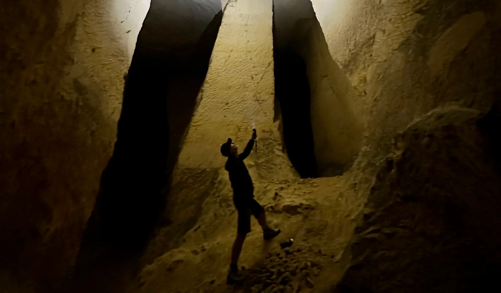
A third, so far unexplored possibility follows the rivers, the principal highways of medieval Europe. From the Seine and the Oise a party could reach the Meuse and follow it north toward the sea near Hoek van Holland, moving through a connected network of waterways rather than a single river. On that network, near Maastricht, lies the Caestert stone quarry, whose underground galleries carry medieval graffiti, carbon dated to the fourteenth century. One gallery is laid out in a cross plan, like a church floor. A large Saint George composition there includes a small figure riding behind the saint and holding a cup, a detail that belongs not to the Western dragon legend, where the rescued princess stands on the ground, but to the Eastern type in which Saint George carries home a rescued Christian cupbearer, a motif essentially absent from medieval Western art. Several four-dot crosses appear on the same ceilings, a sign the Oak Island team has seen at every Templar site visited in the last seven years, and one unique mark in the quarry matches a symbol found in a southern French document from the 13th century. The researchers who catalogued the site treat a Templar connection as a hypothesis and note that drawings of this scale were unlikely to be the work of quarrymen paid by the block, raising instead the possibility of refugees sheltering in the galleries in the fourteenth century. The fuller case belongs in its own account.
 Caestert Quarry Underground Tunnels→
Galleys of the period sat low and shallow in the water and were not built to cross the open Atlantic; they were coastal vessels. Whichever port was used, the fleet would have skirted the European shore, and there the documentary trail ends. Where the treasure went once it reached the sea is not recorded.
The Medieval Dates on Oak Island
5 min
For two centuries the question about Oak Island was one of belief: whether anything is buried there at all. A different question can now be asked of the physical record. Several dozen artifacts and structures recovered on the island return medieval dates through independent scientific analysis, and the dates can be examined together rather than one at a time.
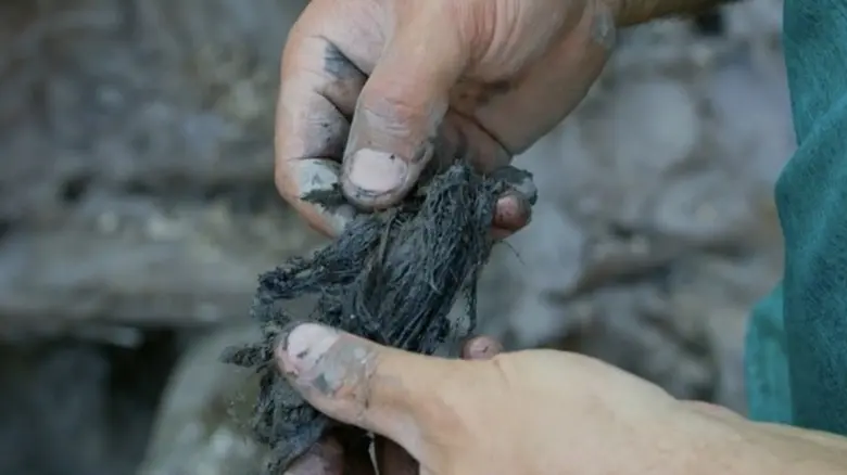
The hardest evidence is radiocarbon dating performed by accredited laboratories. The fibre recovered in volume from the Money Pit and Smith's Cove was tentatively identified by the Smithsonian Institution in 1916 as coconut husk, and reidentified through detailed microscopic and forensic analysis by David Neisen, Robert Cook, and Christopher Boze (2022) as Judean Date Palm (Phoenix dactylifera) trunk fibre. The reidentification matters because it narrows the source. Coconut grows across a broad tropical Atlantic, Indian, and Pacific belt and reaches Europe only through long-distance trade. Phoenix dactylifera is native to the Levant and was cultivated commercially in medieval Judea, the Jordan Valley, and the Eastern Mediterranean coast. If the JDP identification holds, the fibre's provenance is no longer "somewhere tropical" but a specific geography, the Crusader-era Eastern Mediterranean, accessible to a very short list of medieval European operators. The Knights Templar themselves were among that short list, and a documented one. From 1116 until the Battle of Hattin in 1187, the order built and operated three water-powered mills at Jericho (Tawahin a-Sukkar, Er Riha, and Ain Duq) processing sugarcane and date fruit drawn from the surrounding plantations, with the cane grown beneath the date palm canopies. Archaeological residue analysis of the mill ceramics has detected date palm kernel oil, confirming both crops were processed at the same facilities. The Judean cultivar of Phoenix dactylifera grew only in the Jericho corridor and the Dead Sea margins, was extirpated by approximately 1350, and was extinct by approximately 1442. The 1185 to 1330 radiocarbon window the Oak Island fibre returns is the only century in which a European maritime operator could have acquired the material at scale, and the Templars are the documented industrial operators of the only landscape that produced it.
Samples analysed by Beta Analytic and the Woods Hole Oceanographic Institution returned calibrated 2-sigma ranges spanning 1185 to 1330 AD. The material had been retted and prepared for use as cordage and packing, and was recovered in quantities measured in tonnes across the recorded search of both locations. Neither species grows in Nova Scotia and neither can reach the island unaided. Its presence in this volume calls for an explanation involving long-distance maritime transport during the same century the order documented moving relics from the Crusader port of Acre to southern France.
 Coconut fibre (Money Pit)→
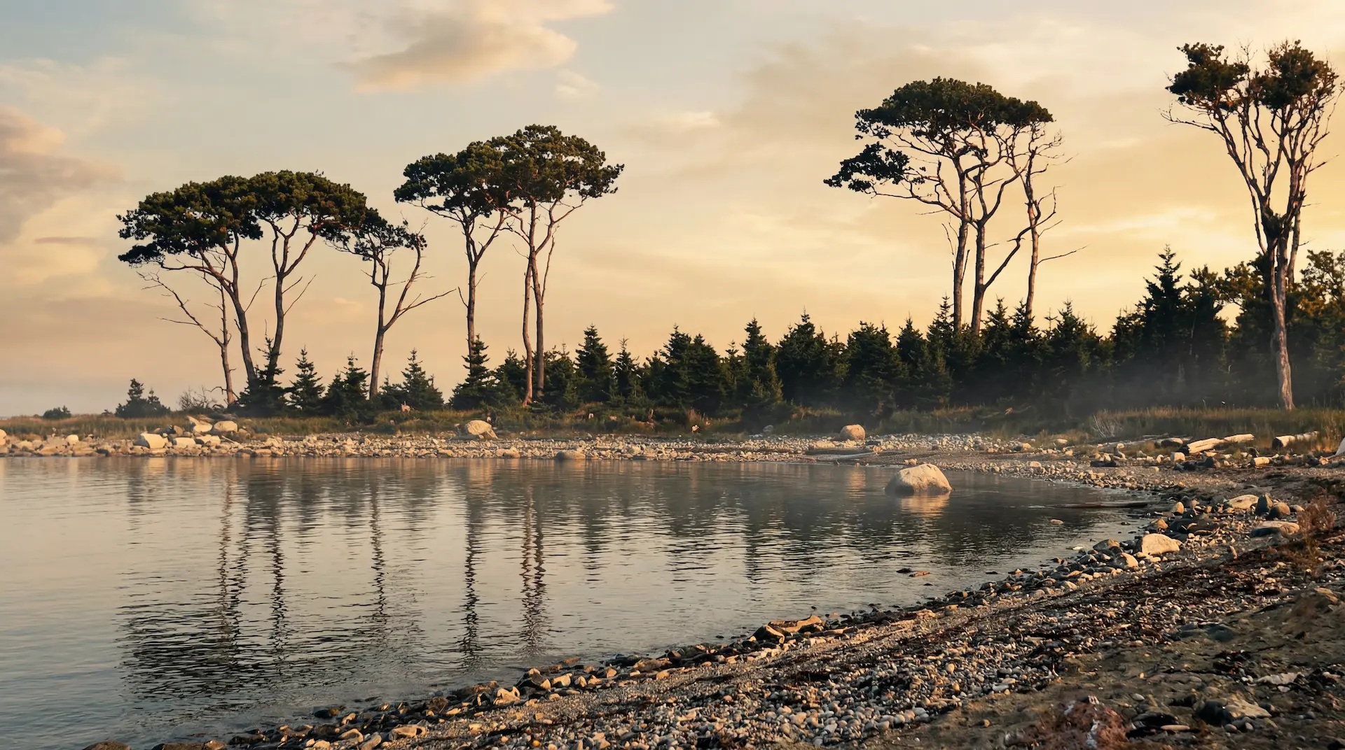 Oak Island Mystery Trees→
On Lot 26, on the south side of the island, geoscientist Dr. Ian Spooner examined a stone well that had drawn attention because it stayed unfrozen through winter. A wood sample from the base of the well dated to the twelfth century, within a range of approximately 1028 to 1172 AD, and the water returned elevated silver content. Spooner described the well's construction as crude and old, distinct from the more refined stonework of eighteenth and nineteenth century Nova Scotia.
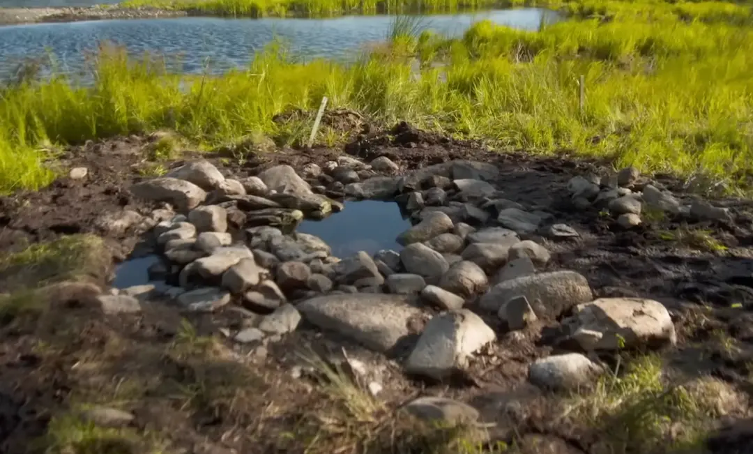 Stone well (never freezes)→
Parts of the Smith's Cove timber structures uncovered by Dan Blankenship in 1969 and 1970 carried a remarkable carbon-14 signature: an oak peg dated to about 860 AD with a range of 720 to 1000, and a beam dated to about 1135 AD with a range of 1025 to 1245.
A paved area uncovered in the swamp returned a radiocarbon date of approximately 1200 AD from wood beneath it, within a range of 1150 to 1250, in what was once an open cove. A buried roadway nearby, the Sand Road in the western swamp, dates to a range of 1200 to 1250.
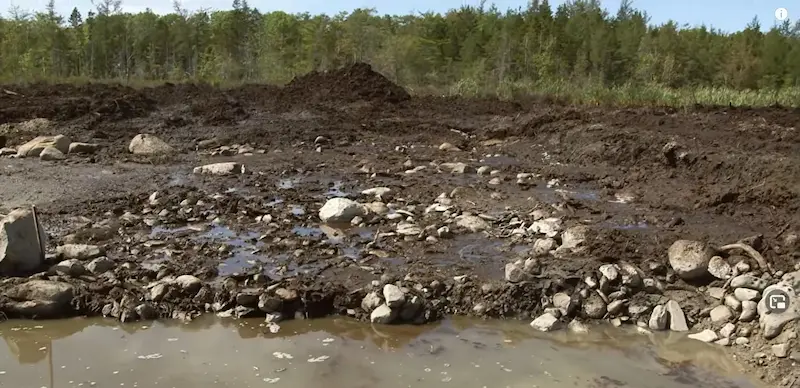 Paved Area / Stone Wharf→
 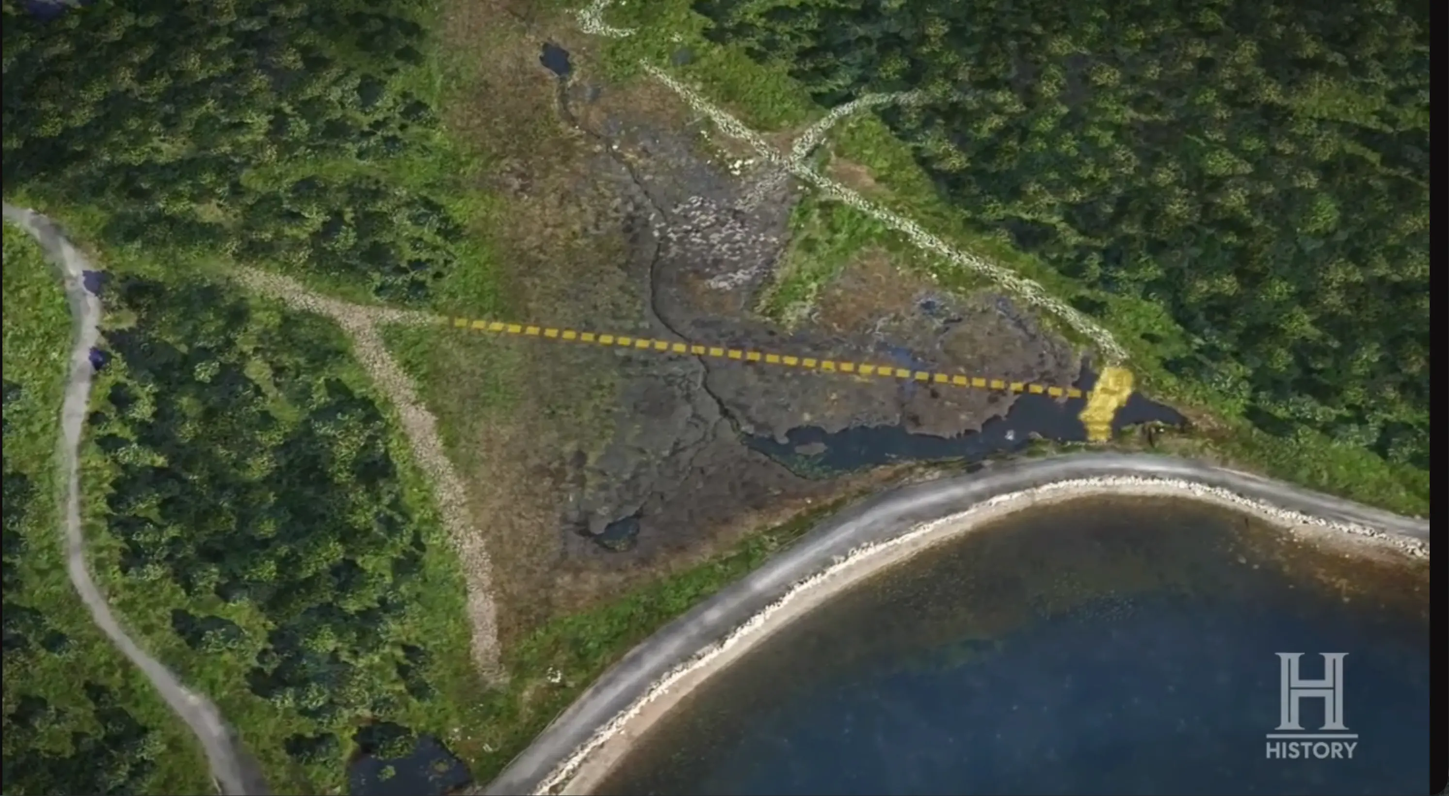 Sand Road (Western Swamp)→
Archaeoastronomer Professor Adriano Gaspani contributed a second dating method. Five large boulders arranged in the shape of a cross, spanning some 720 feet across the island's interior, were first identified by Fred Nolan after decades of surveying. Gaspani analysed the alignment of Nolan's Cross and dated its placement to approximately 1217 AD, within a working range of 1125 to 1275. Gaspani also determined that a series of stone cairns distributed across the island represent the Hyades star cluster and share the same window, approximately 1150 to 1275 AD. Aligning monuments to the stars is a known medieval practice that the Templars made use of.
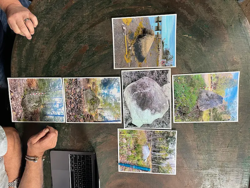 Nolan's Cross (5 boulders)→
 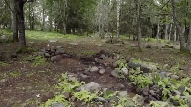 Stone Cairns→
The metal record adds a third method. The lead cross found at Smith's Cove by Rick Lagina and metal detectorist Gary Drayton in 2017 was tested by Tobias Skowronek of the German Mining Museum, who dated it to between 900 and 1300 AD and matched its metal by lead isotope analysis to medieval mines in the Cévennes and Montagne Noire regions of southern France. The cross has a square hole at the top and the form of a devotional object worn around the neck.
Lead cross→
A long, narrow piece of lead with a raised floral pattern, found on Lot 21, returned lead isotope data identical to the Smith's Cove cross. Both objects came from the same French ore source and dating, yet were found on opposite sides of the island. An iron spike from Lot 5 was dated by archaeometallurgist Emma Culligan to 1100 to 1330 AD on its forging characteristics. The iron is hand-wrought, produced by methods consistent with medieval European blacksmithing.
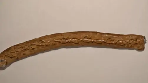 Lead Decorative Piece→
 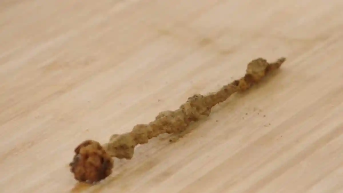 Hand-wrought iron spike (12th-13th century)→
A metal crossbow bolt recovered on Lot 26 has been typologically dated to a range of 1000 to 1299 AD by curator Ane Jepsen Nyborg of the Ladby Viking Museum in Denmark. Crossbow bolts of this kind were standard military hardware in medieval Europe and were not manufactured in North America.
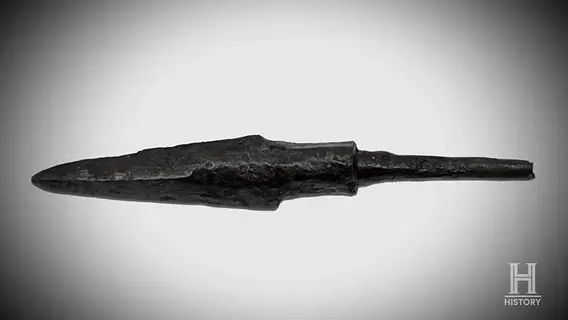 Crossbow bolt (Wroclawski/Dunfield)→
Leather shoe fragments recovered on Lot 13 carry a range of 1148 to 1216 AD. A wound glass bead found on Lot 5, identified as forest glass typical of medieval Normandy, falls within 1100 to 1499. A gold-plated brooch with a leaded glass gem recovered on Lot 18 dates to the fourteenth century or earlier, with a range of 1200 to 1399, based on its threading technique. A boatswain's whistle in bone and ivory, identified by the American Museum of Natural History as most likely Scandinavian and made from walrus tusk consistent with the Norse Greenland ivory trade of the 1200s, falls within 1100 to 1500.
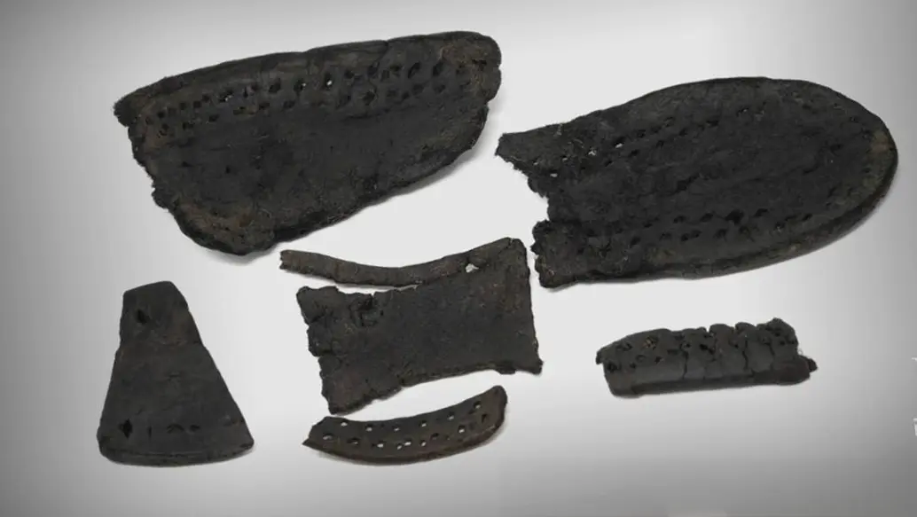 Leather Shoe Fragments→
 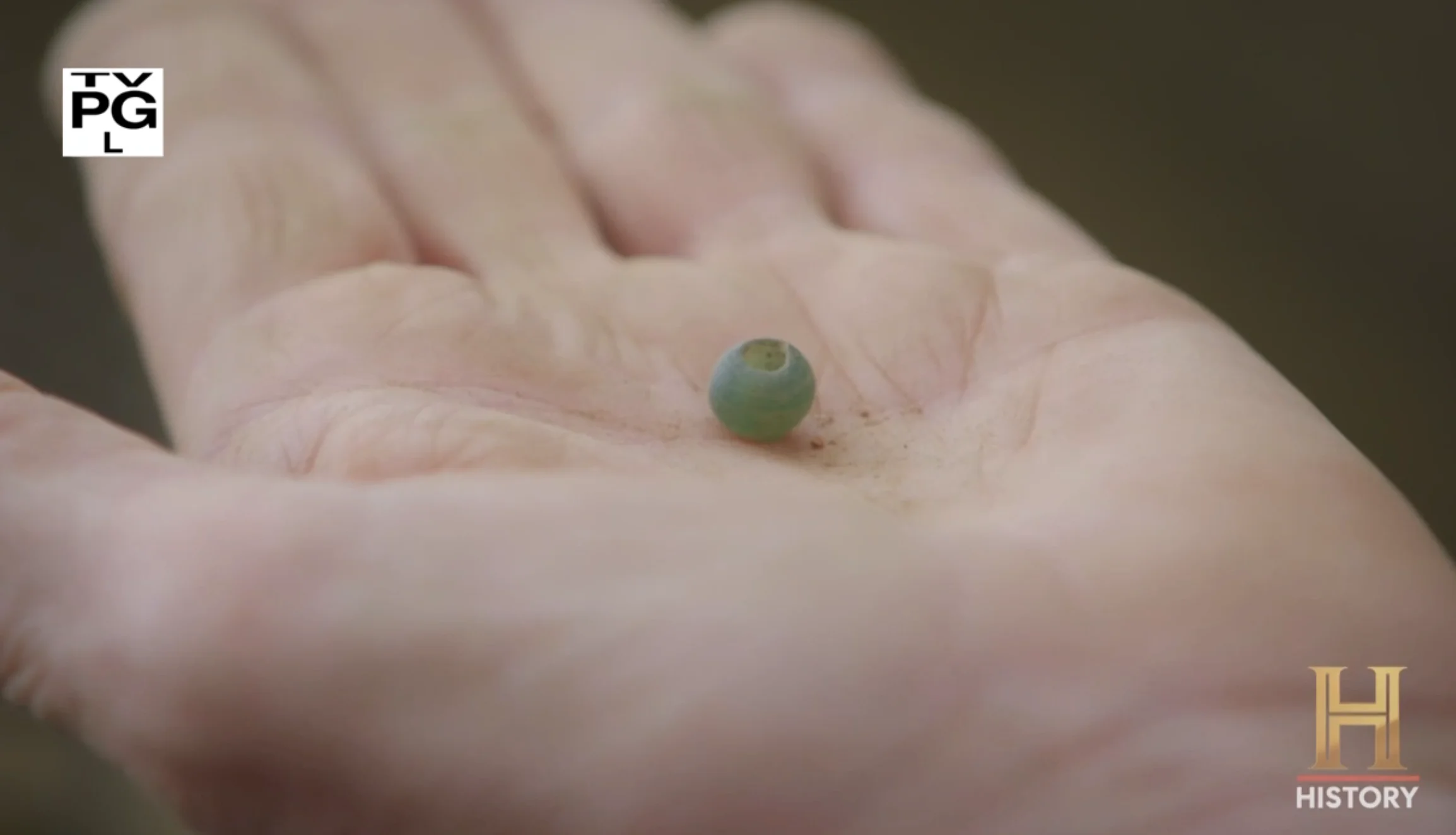 Wound glass bead (forest glass, Normandy)→
 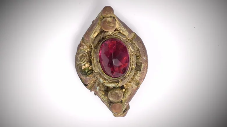 Gold-plated brooch (leaded glass gem)→
 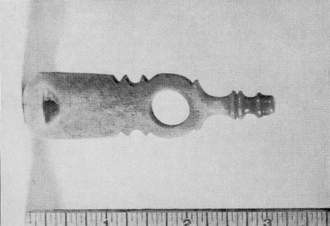 Boatswain's whistle (bone/ivory)→
More Dates
2 min
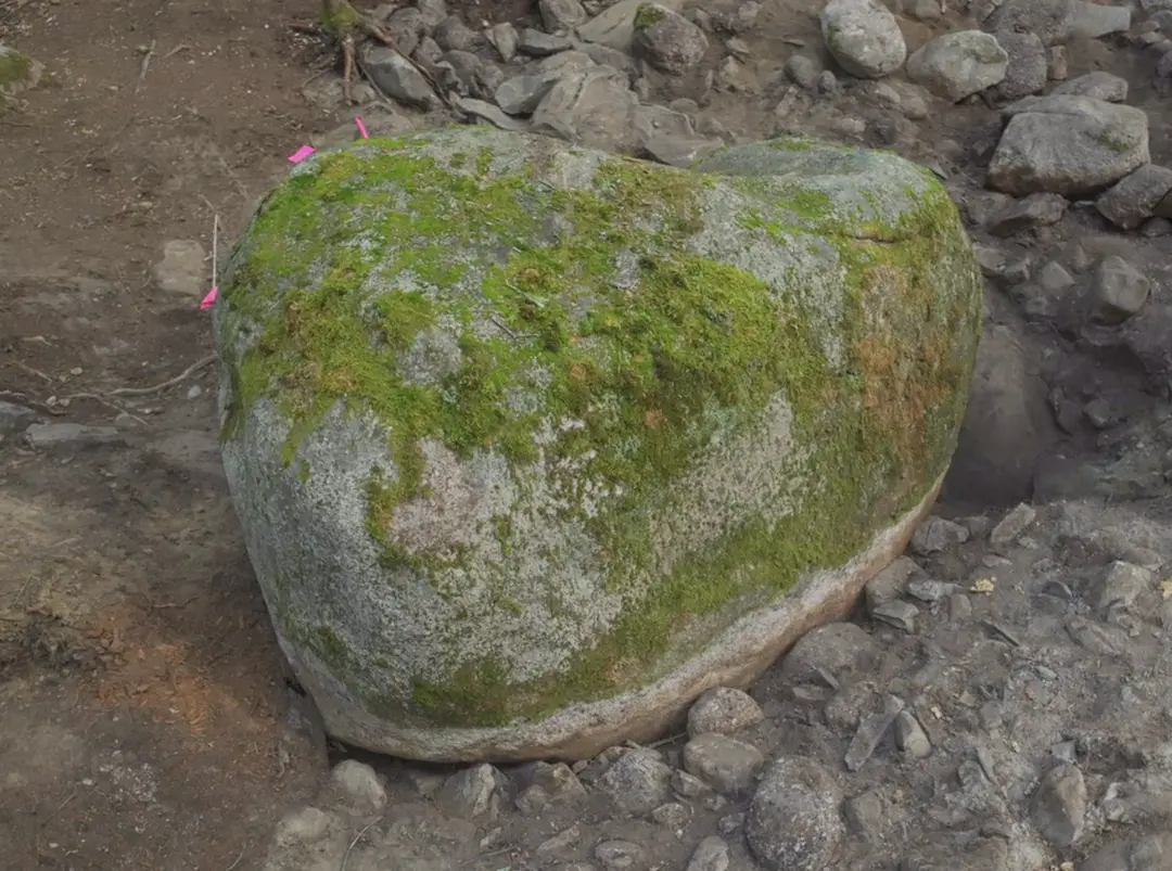
Further dated material rounds out the picture. An iron staple recovered at the Quadrilateral structure on Lot 13 has been placed at 1200 to 1600 AD on context grounds. The Quadrilateral boulder formation itself sits within 1100 to 1500. An ancient trade weight cast in arsenical bronze, a metal no longer produced after the sixteenth century, was estimated at roughly a thousand years old by metal-detection specialist Umberto Moruzzi and at least five hundred years old by Sandy Campbell, giving a working range of 900 to 1500. A copper token bearing unidentified symbols carries a range of 700 to 1599 in the assessment of Dr. Edwin Barnhart. A megalithic boulder feature on Lot 8 analysed by Emma Culligan returned a cradle-binder range of 1200 to 1750, described as premodern and possibly medieval. A purple-stained wood fragment from Lot 18 carries a range of 1100 to 1499.
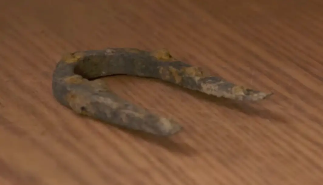 Iron Staple (Quadrilateral)→
 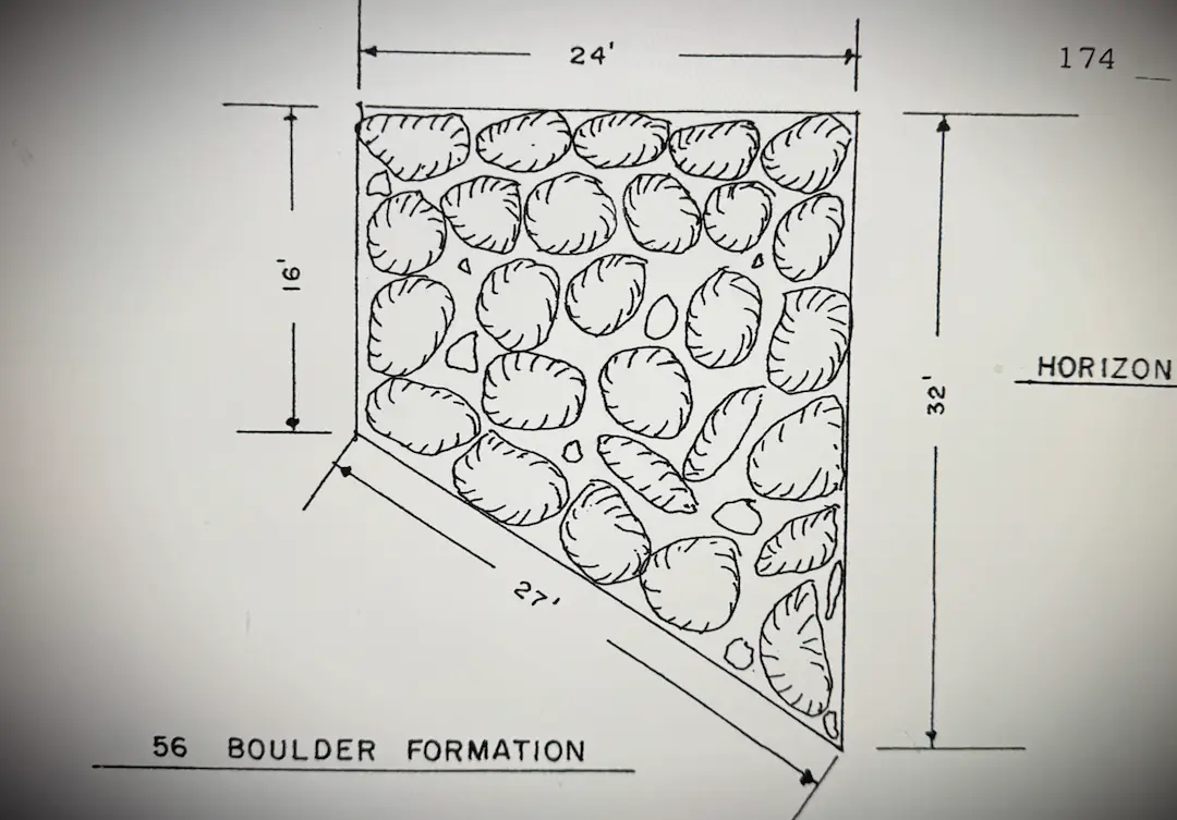 Quadrilateral boulder formation→
 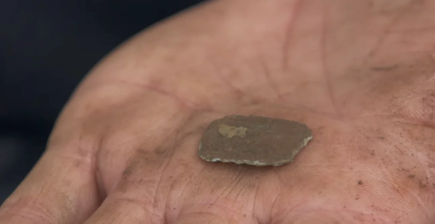 Ancient trade weight→
  Lot 8 Giant Boulder→
Set side by side on a timeline, the ranges overlap, and the overlap is densest in the early thirteenth century. The greatest concentration falls around the year 1211: at that point on the timeline, twenty-three of the island's dated objects and structures have overlapping ranges that could include the year. That figure sits within five years of Gaspani's archaeoastronomical date for Nolan's Cross, 1217 AD, which was reached by an entirely separate method on entirely separate material.
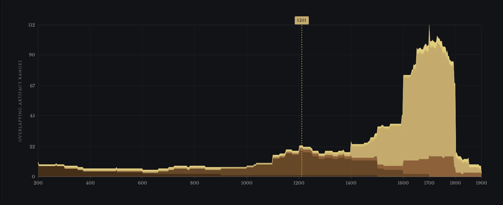
Plotting overlapping date ranges this way is what archaeologists call a summed probability distribution, the standard technique for locating periods of human activity from independently dated material: each artifact contributes equally to every year its uncertainty range covers, with no weighting applied and no period selected for in advance.
The pattern is easier to read against the rest of the island's record. The same exercise produces a far larger mass of overlapping ranges in the colonial period, roughly 1600 to 1750, which is where it should appear: that is the era of settlement and the documented treasure hunt, and it needs no explaining. A concentration of dated material in the early thirteenth century, centuries before any documented activity, is an anomaly, because nothing in the record accounts for it.
The convergence holds across methods. Radiocarbon dating, lead isotope analysis, metallurgical typology, ceramic and contextual dating, and archaeoastronomy were carried out by separate analysts at separate institutions across more than three decades, on different samples drawn from different parts of the island, and the results fall within the same broad window of roughly the eleventh to fourteenth centuries. No single analyst saw the others' work in advance. No single laboratory could have produced the pattern by error. The pattern is what remains when the individual results are placed on a shared timeline.
Oak Island in the Middle Ages
2 min
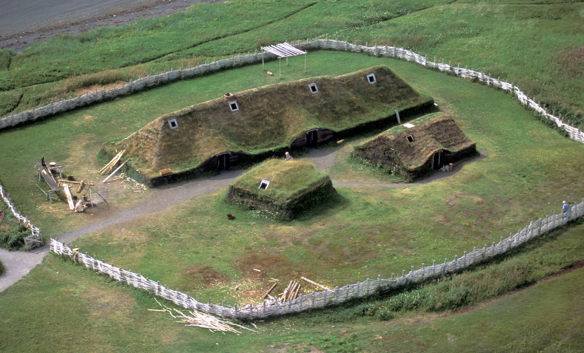
An island in Atlantic Canada is not supposed to return this body of evidence. Nova Scotia has no settled European history before the seventeenth century, and Oak Island has no documented history before the 17th century. The conventional account of North America places the first medieval European contact at L'Anse aux Meadows in Newfoundland around the year 1000, a Norse landing of brief duration that left a small settlement and little else. Oak Island lies more than seven hundred miles south of L'Anse aux Meadows. The expected scientific yield from such a place, in a region whose pre-colonial archaeology is dominated by Mi'kmaq material, is zero medieval European artifacts. The Mi'kmaq pottery finds on Oak Island are of course excluded from the comparison here because it is the indigenous baseline of this coastline and would be expected at any Mahone Bay site; the rest of the medieval cluster, French-mined lead, hand-wrought European iron, Norse walrus ivory, forest glass from Normandy, and a Latin-cross devotional object, belongs to a material culture with no overlap with Mi'kmaq archaeology. The recovered yield is almost two dozen dated objects and structures clustering on a single decade of the early thirteenth century, traceable to materials and methods that match medieval European workshops, mines, and astronomical practice.
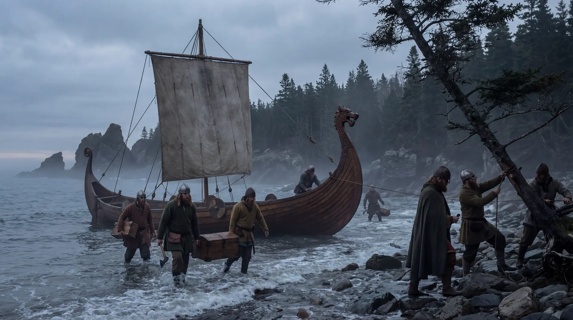
What the dates establish is a medieval presence. They do not, on their own, name who left it. The stone well, the timber structures, the paved area, and the buried road point to people who stayed long enough to build. The crossbow bolt and the iron spike point to men who were armed. The lead cross and the decorative piece point to a southern French origin. The boatswain's whistle points north to the Norse ivory trade. The brooch and the wound glass bead point to medieval European workshops. Each find, taken alone, can be questioned. Taken together, they support the hypothesis of an operation rather than a single landing. The Knights Templar were active from 1119 to 1312 AD, and the order's span overlaps the window almost exactly. That overlap is documented. The direct connection is not, and the case rests on physical evidence that can be retested at any accredited laboratory rather than on inference from unverifiable sources. There is every indication that medieval Europeans reached Oak Island in the 13th century. Further research must establish who they were and if the Templar hypothesis holds.
Oak Island dates: 100 years before the downfall
2 min
The window the dates point to is not the one the popular Oak Island Templar story occupies. The familiar narrative is the 1307 collapse: Philip's arrests, the empty treasury at the Paris Temple, the eighteen galleys that left at dawn. Oak Island's densest cluster of medieval dates falls on the year 1211, almost a hundred years before Philip's officers found that treasury empty. The order was then at full strength, its officers still living in their commanderies in Paris and Provence, its ships still flying its own banner, its books in order. If a Templar story is at work on the island, it is not the story of fugitives hiding what they could carry. It would be the story of an organisation acting from a strong position, with shipyards, treasury, fleet, and command intact, moving something deliberately across an ocean for purposes of its own. That is a different story, and a harder one. On the evidence, it is the more interesting one.
The number of entities in medieval Europe capable of staging such a movement was very small. A transatlantic operation in the early thirteenth century would have required deep-water ships rather than Mediterranean galleys, navigators capable of finding the way back, crews bound by enough discipline to keep silent for the rest of their lives, capital sufficient to absorb a multi-year expedition without showing in the accounts, and a motive strong enough to justify the cost. The Italian maritime republics had the money and the ships but their interests faced east toward Constantinople and Alexandria, not west. The English and French crowns had limited navies and no reason for secrecy. The Norse who had reached Newfoundland two centuries earlier were by then a declining community in Greenland with no documented capacity for a sustained programme. The military orders, the Templars first among them and the Hospitallers behind, combined all five requirements in one institution: their own fleet, their own treasury, sworn brothers under religious vows, astronomical knowledge brought back from the Levant, and the kind of long-running internal project that need not appear in any chancery record. That short list of candidates is not proof of who built on Oak Island. It is the size of the pool from which the answer has to come if the hypothesis holds.
One piece of evidence possibly has the power to swing the scales towards more definite answers. If Neisen, Cook, and Boze are right and the Money Pit and Smith's Cove fibre is indeed Judean Date Palm trunk fibre, the medieval dating cluster includes actual cargo from the area of the Holy Land, recovered in quantities measured in tonnes, dated to the Crusader century.
Sources
5 min
Templar founding and history
- Bernard of Clairvaux, In Praise of the New Knighthood (Liber ad milites Templi: De laude novae militiae), c. 1129. Theological justification for the Templar warrior-monk model.
- Council of Troyes, 13 January 1129. Papal recognition of the Knights Templar; Bernard wrote their Rule.
- Pope Innocent II, papal bull Omne Datum Optimum, 29 March 1139. Exempted the Templars from taxes and local authority and placed them under direct papal protection.
- The vessel Montjoie, 1254: relics shipped from Acre to southern France. Documented in Corjan Mol and Christopher Morford, The Jerusalem Files (Watkins / Penguin Random House, 2024).
Suppression, flight, and the escape routes
- Ponsard de Gizy testimony, Paris trials, November 1309. Procès des Templiers, ed. Jules Michelet, 2 vols. (Paris: Imprimerie Royale, 1841–1851), vol. I. States that Gérard de Villiers had left Ruad a day before the siege closed, taking his friends with him.
- Jean de Châlons testimony, Papal Inquisition at Poitiers, June 1308. Procès des Templiers, ed. Michelet, vol. I. Records the leaders' flight, Gérard de Villiers and eighteen galleys, and Hugues de Châlons escaping with the treasure of Hugues de Pairaud. Also in Alain Demurger, Jacques de Molay (Paris: Payot, 2002) and Barbara Frale, L'ultima battaglia dei Templari (Rome: Viella, 2001).
- Registre de Philippe le Bel, contenant des lettres et des mémoires sur l'affaire des Templiers et sur les rapports avec la cour de Rome, July 1308. Bibliothèque nationale de France, Archives et Manuscrits, Latin 10919, folio 236v. States that Hugh de Châlons, nephew of the Visitor, and Gérard de Montclair, knights of the Temple, with accomplices, had planned to kill the King (conceperant occidere regem). Latin transcription and translation by Corjan Mol.
- Émile-G. Léonard, Introduction au Cartulaire manuscrit du Temple (1150–1317) (Paris: Champion, 1930). Identifies Hugues de Châlons, preceptor of Épailly, as probably identical with Hugh of Villiers. Humbert de Pairaud as Master of England and Aquitaine (1266–1271) in Alain Demurger, Les Templiers: Une chevalerie chrétienne au Moyen Âge (Paris: Seuil, 2005) and the Procès des Templiers.
- Corjan Mol and Christopher Morford, The Jerusalem Files (Watkins / Penguin Random House, 2024). The De Châlons/De Villiers and Pairaud identities, the Paris Temple treasury, and the case for Rouen and the river network over La Rochelle, including the Clos-des-Galées shipyard.
The Caestert quarry
- Joris de Lange, Ruben Philipsen and Jacquo Silvertant, "Lost knowledge on the meaning of historical graffiti at the underground Caestert stone quarry." Describes the cross-shaped gallery, the Saint George composition, a mark matching early-thirteenth-century Languedoc Templar documents, and the fourteenth-century refugee hypothesis. Jacquo Silvertant first proposed Templar symbolism at the site in 1999; the authors treat the connection as unproven.
- Saint George and the Youth of Mytilene: the Eastern iconographic type in which a rescued Christian cupbearer rides behind the saint holding a vessel. British Museum icon, c. 1250, identified by Robin Cormack and Stavros Mihalarias (1984). Field observation of the cup-bearing figure and the four-dot crosses at Caestert by Corjan Mol.
Radiocarbon dating
- Beta Analytic report Beta-39897 (1990): 770 ±60 BP, calibrated 2σ 1168–1374 AD. Coconut fibre from Smith's Cove. Previously identified as coconut fibre by the Smithsonian Institution and the Botanical Museum of Harvard University.
- Beta Analytic report Beta-66584 (1993): 820 ±70 BP, calibrated 2σ 1036–1298 AD. Sample from behind an old board wall at Smith's Cove.
- Woods Hole Oceanographic Institution receipt 10168 / OI-3-CF2 (1995–96): 765 ±35 BP, approximately 1185 AD.
- Primary compilation: Les MacPhie, "Summary of Documents and Results for Carbon Dating at Oak Island" (compiled July 2006).
- Dr. Ian Spooner, geoscientist. Wood from the base of the stone well on Lot 26, dated to the twelfth century (range approximately 1028–1172); elevated silver in the water. Charred wood from the Eye of the Swamp, carbon-dated to approximately 1100 AD (range 1050–1150).
- Smith's Cove timber structures excavated by Dan Blankenship 1969–70. Oak peg ~860 AD (720–1000); beam ~1135 AD (1025–1245).
- Paved area in the swamp: radiocarbon date of wood beneath the surface, approximately 1200 AD (range 1150–1250). Sand Road in the western swamp: pre-colonial, 1200–1250.
Botanical analysis
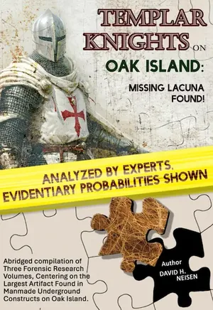
- David H. Neisen, Robert W. Cook, and Christopher L. Boze, Oak Island Mystery Trees and Other Forensic Answers, four-volume series (2022–2024), with Templar Knights on Oak Island: Missing Lacuna Found (Hammerson Peters Publishing, 2025) as Volume IV. Microscopic and forensic reidentification of fibre samples recovered from the Money Pit and Smith's Cove as Phoenix dactylifera (Judean Date Palm) trunk fibre, updating the 1916 Smithsonian Institution identification as coconut husk. Volume IV documents the Knights Templar agricultural operations at Jericho from 1116 to 1187, including three water-powered mills (Tawahin a-Sukkar, Er Riha, Ain Duq) processing sugarcane and date fruit, citing Hamdan Taha (2009), Meron Benvenisti (1970), and Richard Jones's "Sweet Waste" report on the 2002 Tawahin es-Sukkar excavation. The reidentification and the Jericho documentation are the source of the Eastern Mediterranean provenance attribution used in this article.
Archaeoastronomy
- Professor Adriano Gaspani, archaeoastronomer. Nolan's Cross dated to approximately 1217 AD (working range 1125–1275). Stone cairns identified as a Hyades representation, dated approximately 1150–1275 AD.
Metallurgical, isotope, and typological analysis
- Tobias Skowronek, German Mining Museum (Deutsches Bergbau-Museum), Bochum. Lead cross from Smith's Cove dated 900–1300 AD, matched by lead isotope analysis to the Cévennes and Montagne Noire, southern France. Lead decorative piece from Lot 21 with identical isotope data, pre-1400.
- Emma Culligan, archaeometallurgist. Hand-wrought iron spike from Lot 5, dated 1100–1330 AD on forging characteristics. Lot 8 megalith cradle-binder analysis: post-1200s to pre-mid-1700s. Woven-pattern coin from Lot 5 identified as a thirteenth-century French denier.
- Crossbow bolt from Lot 26: typologically dated approximately 1000–1299 AD; assessment by curator Ane Jepsen Nyborg, Ladby Viking Museum, Denmark.
- Boatswain's whistle (bone/ivory) identified by the American Museum of Natural History as most likely Scandinavian, walrus tusk ivory consistent with the Norse Greenland ivory trade of the 1200s.
- Wound glass bead from Lot 5: forest glass typical of medieval Normandy, as early as the tenth century.
- Gold-plated brooch with leaded glass gem from Lot 18: fourteenth century or earlier on threading technique.
- Ancient trade weight: arsenical bronze, no longer produced after the sixteenth century; estimated at roughly a thousand years old by Umberto Moruzzi and at least five hundred years old by Sandy Campbell.
- Metal token (copper, unidentified symbols): assessed by Dr. Edwin Barnhart as either Viking-era (8th–11th century) or 16th-century European.
- Leather shoe fragments from Lot 13: 1148–1216 AD.
- Iron staple and Quadrilateral boulder formation, Lot 13: dated to well before 1795 on archaeological context.
- Mi'kmaq pottery recovered from the swamp: 500 to 2,500 years old.
Further reading
- Corjan Mol and Christopher Morford, The Jerusalem Files: The Secret of the World's Most Famous Treasure Hunt (Watkins / Penguin Random House, 2024).