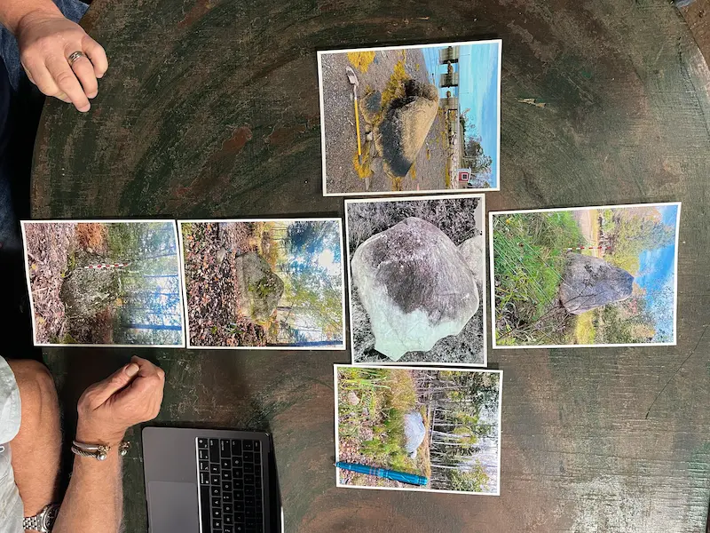
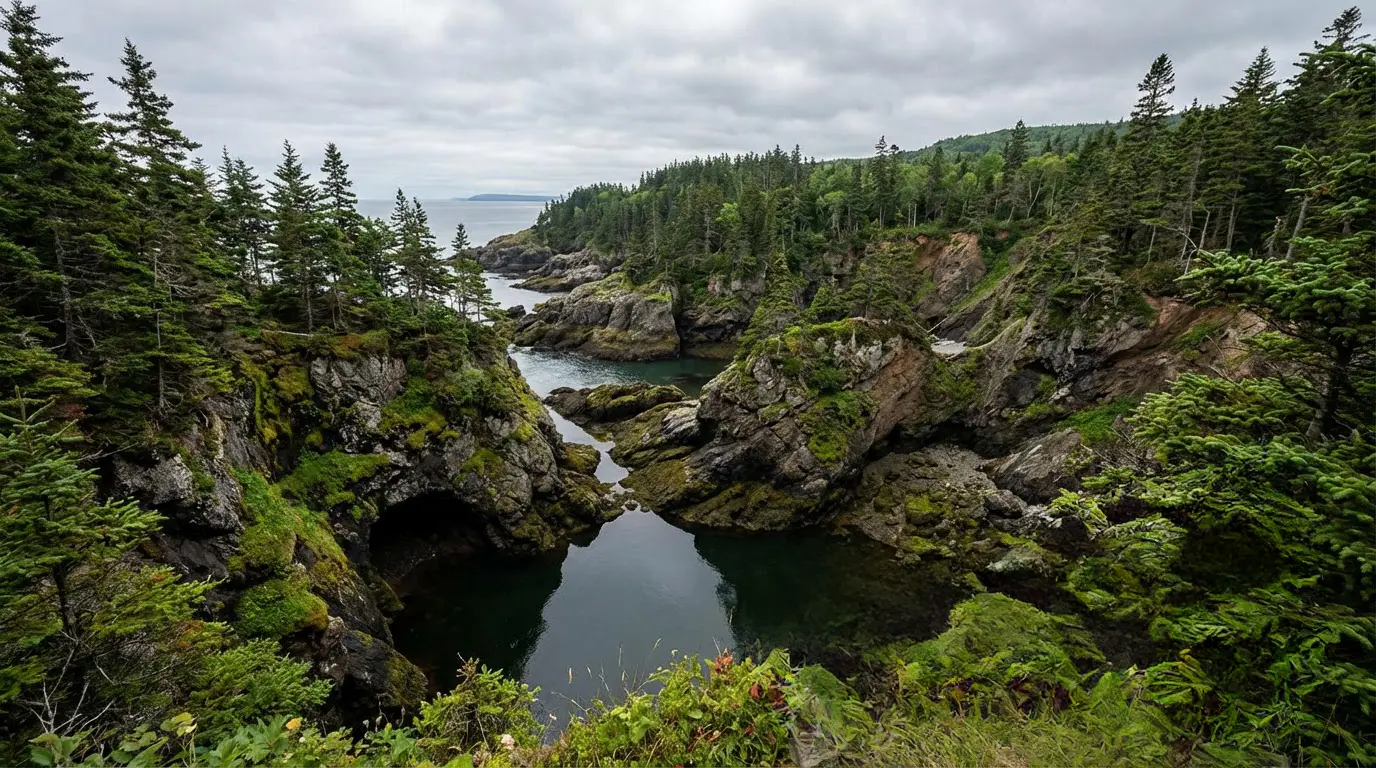
Fred Nolan was a professional land surveyor based in Bedford, Nova Scotia. He first visited Oak Island in 1957 and spent the following years laying out a grid that covered the entire island, cutting sight lines through the brush for tens of thousands of yards at his own expense. He produced more than 104 maps. While the Triton Alliance consortium poured its resources into the Money Pit, Nolan was on his hands and knees across the western half of the island, cataloguing every stone, every carved feature, every marker he could find. He was trained to measure distances and testify in court about what he found. He was not the kind of man who saw patterns where none existed.
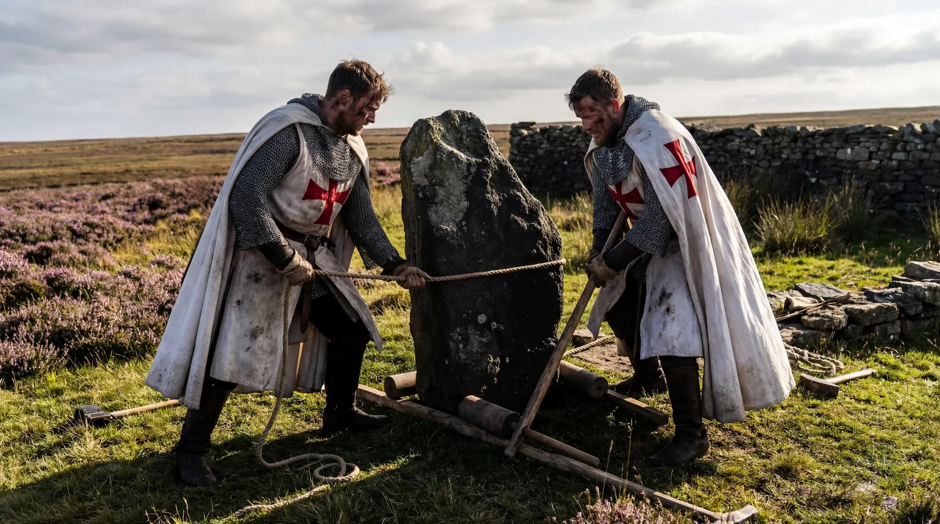
It was during this work, in the early 1980s, that Nolan noticed geometric alignments forming along his transit lines. He investigated the intersection points and found cone-shaped boulders buried under soil and vegetation. One by one, he uncovered them, marked their positions, and measured the distances between them. During the 1960s, before the pattern had become apparent, he had moved one boulder (later designated Cone A) because it blocked a survey sightline. He did not yet know the cross existed. Both Nolan and Crooker later measured from the depression the stone had left in the ground rather than from the boulder itself. By 1981, the picture was clear: five large granite boulders, each weighing approximately ten tons, arranged in the shape of a cross. The formation measured 360 feet wide and 867 feet tall, oriented roughly northeast to southwest. A sixth stone, made of softer sandstone, was found buried at the midpoint between the arms. This central stone appeared to bear the features of a crude human head with what Nolan described as a carved face and sword image, traits that some researchers later associated with Templar tomb effigies. Nolan insisted that no boulders of similar size or shape existed elsewhere in the vicinity.
 Nolan's Cross (5 boulders)→
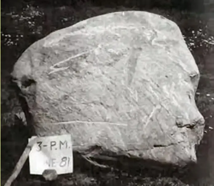 Head Stone (human face/sword)→
The Feud
Nolan did not reveal his discovery for more than a decade. In 1983, Triton Alliance launched a lawsuit challenging his ownership of seven lots in the centre of the island, and the cross sat on that disputed land. The legal fight was the peak of a rivalry between Nolan and Dan Blankenship that had been building since the late 1960s. Access roads were blocked and rebuilt. Nolan chained off the island's only road where it crossed his property, cutting Triton off from the Money Pit by ground. Blankenship approached Nolan with a rifle. Police confiscated the weapon. Nolan was forced to reach his own land by boat, spending eighty thousand dollars to build a dock because the causeway was closed to him.
The trial came in December 1985. Justice A. M. MacIntosh upheld Nolan's ownership. Triton appealed. Nolan cross-filed. In April 1987, the appeal court ruled in Nolan's favour again. By then he had spent seventy-five thousand dollars on lawyers and estimated his losses from the damage to his survey business at more than a quarter of a million dollars. Triton had publicly portrayed him as a kook, and the companies that once hired him as an expert witness stopped calling.
With the court case settled, Nolan had fellow Nova Scotia surveyor William Crooker verify his measurements independently. Crooker confirmed them. In 1992, Crooker published the details in a book titled Oak Island Gold, and reporter Steve Proctor covered the story in the Halifax Chronicle-Herald. When author William Finn asked Nolan why he had waited so long, Nolan answered with surprising candour: he had been afraid that if something happened to him, the discovery would be lost forever. The implication, as both Finn and author Randall Sullivan noted, was that Nolan feared Blankenship might make something happen.
The feud meant that for years after the cross was announced, it was treated as Nolan's private obsession rather than an archaeological feature worth investigating. Because it belonged to Nolan, it was dismissed by the Blankenship and Triton camp. The Lagina brothers brokered a fragile peace in Season 3 of The Curse of Oak Island. Nolan, then 87 years old, brought his maps to the War Room for the first time. He died in 2016. His son Tom joined the team the following season, and the cross finally became accessible to researchers who had been locked out for decades.
The Case Against
The skeptic's position deserves to be stated clearly, because it is not unreasonable. Oak Island is a drumlin, a mound of compacted glacial debris shaped by ice sheets that retreated roughly ten thousand years ago. Boulders of various sizes are found across its surface. Given enough points on any terrain, the human eye will find patterns. Five stones on a small island can be connected to form a cross, a star, or a dozen other shapes depending on which lines you choose to draw. This is a well-documented cognitive tendency, not a conspiracy. As architect and researcher Brian Pharoah later pointed out, however, if connecting random boulders into geometric patterns were truly that easy, someone should have found other shapes on the island: squares, triangles, pentagrams. In more than two centuries of searching, no one has. Only this one formation.
A geologist at the Nova Scotia Museum of Natural History, consulted by Finn in the early 1990s, stated that the boulders had most probably been deposited by glaciers. He acknowledged he had not carried out a detailed study of the formation or the surrounding area. Even Finn himself, walking the site in April 1993 alongside a British television crew, admitted that despite the precision of the arrangement, nature might still have been responsible.
For forty years after its discovery, the formation had no parallel anywhere on earth. Five megaliths arranged in a cross pattern, with those specific proportions, at that scale, had been documented in exactly one place. Without a second example, the formation could always be treated as a statistical anomaly, a one-off arrangement of glacial stones that happened to look meaningful to a surveyor who spent years staring at his own property.
That is the case against. It rests on three pillars: glacial geology, pattern recognition bias, and the absence of a precedent. Each of these has since been challenged.
 The Natural Formation Theory→
The Surface Evidence
Halifax geologist Petra Mudie examined the site twice, and her conclusion was the opposite of the museum geologist's assessment. The boulders were not seated in glacial till, the compacted mix of clay and gravel that glaciers leave behind when they deposit stones. They sat on the surface in positions that, in Mudie's professional opinion, were not consistent with glacial deposition. Their cone shapes were unusually uniform for a collection of erratics.
In 2016, the producers of The Curse of Oak Island brought two stonemasons to the island to examine the boulders. The stonemasons were unable to say whether the central sandstone (the headstone) had been carved, because it was too weatherworn. But when they examined the cone stones forming the arms and body of the cross, both agreed that the smoothness of the undersides was not natural. In their assessment, the stones had been dragged a considerable distance. Smooth undersides are consistent with boulders that have been transported across ground. They are not consistent with stones that were deposited in place by melting ice.
Nolan himself had noted during his surveys that no boulders of comparable size or shape existed elsewhere on the island. If the five stones were glacial, they were the only ones of their kind on a drumlin covered in glacial debris, which would itself be an unusual concentration requiring explanation.
What Lies Beneath
Surface boulders, however precisely arranged, can always be argued away. What cannot be argued away is what was found underneath them and, more critically, what was found buried at positions that no one knew to look at until geometry predicted they should be there.
Nolan later moved the boulder at the southern arm (Cone B) to explore what lay beneath it. He and a co-worker found a layer of small beach stones and pieces of a ship's pot-belly stove. He could not explain how either came to be there. Pharoah later observed that the small beach stones would have been ideal material for leveling and accurately placing a boulder of that size, a practical engineering detail rather than a geological accident. Nature does not usually place smaller stones under larger ones in that configuration. William Crooker independently confirmed the stove find in his book Oak Island Gold, having verified the account with one of the workers who was present at the time. The stove pieces and cutlery have since been lost, and their current whereabouts are unknown, but their presence beneath a supposedly glacial erratic is not addressed by the coincidence theory. Glaciers do not deposit stove parts under ten-ton boulders, and they do not arrange leveling stones beneath them.
The more decisive evidence came in May 2003, when Norwegian researcher Petter Amundsen visited Oak Island. Amundsen had projected the Kabbalistic Tree of Life onto Nolan's Cross and calculated that the distances between the cone boulders corresponded to the distances between specific Sephirots. If his geometric model was correct, additional stones should exist at two positions that were not visible on the surface: the Kingdom point (Malkuth) and the Victory point (Netzach). Amundsen dug at the Kingdom position and found a large flat stone buried just below the surface. He found another at the Victory position. Dan Blankenship subsequently reburied the Kingdom Stone to conceal it from Fred Nolan. When Amundsen returned in Season 1, Episode 4 of The Curse of Oak Island, he guided the Lagina brothers to the general area but inadvertently selected the wrong stone to unearth.
 Shakespeare and Oak Island→
The buried stones are the turning point in the argument. A skeptic can attribute five surface boulders to glacial coincidence. A skeptic cannot attribute buried stones, invisible from the surface, found at positions predicted by a geometric projection, to the same coincidence. Whatever one makes of the Tree of Life as an interpretive framework, the stones were where Amundsen calculated they would be. Someone placed them there, and that someone understood the geometry of the formation well enough to embed secondary markers underground.
 Kingdom Stone (Malkuth)→
The Numbers
Brian Pharoah is an architect by profession, trained in the same disciplines of measurement, proportion, and spatial design that produced the buildings he would later compare to the formation. He approached Nolan's Cross not as a symbol but as a problem in applied geometry, and he began with the measurements themselves. Nolan's original dimensions placed the long axis at 867 feet and the short axis at 720 feet, with internal segments of 145, 293, and 429 feet. Pharoah proposed slight adjustments: 144 for 145, 288 for 293, 432 for 429, reducing the long axis from 867 to 864 feet. The short axis at 720 feet remained unchanged. His reasoning was practical. The boulders are six feet wide or more. There is no fixed measuring point on top of a cone-shaped granite boulder, no X marking the spot. Nolan and Crooker were measuring to slightly different positions on six-foot-wide stones, and centuries of freeze-thaw cycles may have shifted the boulders fractionally from their original placement. Even Nolan himself stated there was some latitude in his measurements. Pharoah's adjusted figures still land squarely on top of each boulder. They do not move the stones. They move the measuring point by inches on a surface that spans feet.
With those adjustments, a set of numbers appeared: 144, 288, 360, 432, 720, and 864. Pharoah demonstrated that these same figures occur in the construction measurements of Chartres Cathedral, Rosslyn Chapel, and the Temple Mount in Jerusalem. The numbers are not arbitrary. They belong to a system of proportional geometry that medieval builders used to encode astronomical and theological information into the fabric of their buildings. The number 144 is 12 squared. 288 is twice 144. 432 is three times 144. 720 is five times 144. 864 is six times 144. The proportional relationships are internally consistent and they repeat across structures separated by thousands of miles and several centuries.
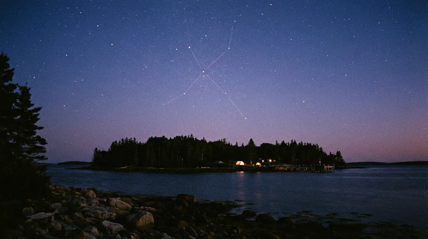
Pharoah also noted a specific alignment within the formation that the raw dimensions alone do not reveal. Cones D and E, the two boulders forming the lower portion of the cross, sit on matching latitude bearings at North 44 degrees 30 minutes. They are separated by exactly 288 feet on a 60-degree bearing from north. Two conical boulders of matching size and shape, 288 feet apart, on an exact bearing alignment. The 60-degree bearing corresponds to the direction of sunrise on the spring equinox. Pharoah concluded that the cross functions as an astronomical calendar aligned with the equinoxes and solstices, with the constellation Cygnus and its Northern Cross asterism playing a central role in the design. He presented his findings in a War Room segment during Season 10, Episode 13 ("All's Well"). Steve Guptill recalculated using Pharoah's method with the team's own boulder positions and arrived at a spot a few feet north of the Garden Shaft.
Pharoah's work does not prove who built the formation or when. It establishes that whoever designed it was working within a tradition of proportional geometry that was in active use among European builders during the medieval period. If the formation is glacial, the glaciers replicated the construction ratios of Chartres Cathedral by chance, placed two matching boulders on an exact compass bearing 288 feet apart, and aligned the long axis with the winter solstice sunset.
 The Oak Island Star Map→
The Sightlines
If Pharoah showed what the numbers encode, researcher Christopher Morford demonstrated what the formation points at. Morford, a Freemason and co-author of The Jerusalem Files, presented his theory in a War Room segment during Season 11 of The Curse of Oak Island. He had been studying the relationship between the cone boulders and a set of drilled stones found at various locations on the island.
Morford demonstrated that two of the cone-shaped boulders align precisely with two drilled stones, and that the resulting sightline runs directly to the Money Pit area. The first boulder in the sequence, Cone C, sits on the beach where it would have been visible to an incoming ship. A rock with a drilled hole lies between Cone C and Cone A at the top of the formation. A second drilled rock lies in a direct line beyond Cone A. Rick Lagina reminded the group that a third drilled stone had been found in the Money Pit area in 1895 but was subsequently moved from its original position. Surveyor Steve Guptill walked the line in the field and confirmed the geometry. Four lines measured from Nolan's Cross, Morford argued, converge on the Garden Shaft.
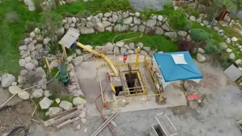 Garden Shaft→
The formation, in Morford's reading, is not a monument. It is a surveying instrument. The same structure that Adriano Gaspani dated to approximately 1200 AD using archaeoastronomical methods appears to have been engineered as a ground-level navigation system directing anyone who understood it to a precise underground location. Pharoah's celestial geometry and Morford's terrestrial sightlines are consistent with a single construction by builders who understood both astronomy and practical surveying.
The Precedent
The third pillar of the skeptic's case was the absence of a parallel. For four decades, that pillar held. It no longer does.
At Temple Beeld, on a hilltop in the North York Moors between Danby and Lealholm in Yorkshire, England, five megalithic stones stand in a formation that mirrors the Oak Island boulders. The name carries historical weight: "Temple" denotes land once held by the Knights Templar, and "Beeld" is an old English word for shelter. The property was held by Templar knight William de Villiers. The arm angles of the Temple Beeld formation measure approximately 60 and 150 degrees from the vertical axis. The central stone is offset from the geometric centre of the cross, exactly as on Oak Island. Later walls were built between the stones to shelter sheep, using the megaliths as anchoring points. The builders of those walls were careful not to damage the standing stones. The walls appear to be a few hundred years old. The megaliths are estimated to be at least fifteen hundred years old.
Two formations on opposite sides of the Atlantic. Same number of stones. Same angular geometry. Same off-centre placement of the central stone. One stands on confirmed Templar property in England. The existence of Temple Beeld does not prove that the same builders were responsible for both formations. It proves that Nolan's Cross is not unique, and that the argument from coincidence must now account for two coincidences rather than one.
 Before Nolan's Cross: Temple Beeld Cross→
The Fifth Stone
Every reading of the formation, whether as a cross, a calendar, or a survey instrument, encounters the same unresolved problem. A Latin cross has four endpoints. A Greek cross has four endpoints. Every variation of a cross requires four stones to define its shape. The formation on Oak Island has five cone-shaped boulders. Cone D, positioned roughly one-third of the way up from the base of the vertical axis, has no geometric function within any standard cruciform interpretation. It is present. It is part of the formation. No researcher has satisfactorily explained why it is there.
Fred Nolan spent the last decades of his life convinced that an undertaking of extraordinary proportions had taken place on Oak Island, carried out by people with knowledge of engineering, mathematics, and symbolism. He died in 2016 without resolving the mystery of the formation that bears his name. Even Dan Blankenship, who had scoffed at the cross when it was first announced, eventually added it to his own survey grid in red highlights. When Randall Sullivan interviewed him in 2003, Blankenship acknowledged the formation with a qualifier: his problems with Fred were well known, but the cross was real.
The case against rested on glacial geology, pattern recognition, and the absence of a precedent. Petra Mudie's examinations undermined the first. The buried stones at predicted positions undermined the second. Temple Beeld undermined the third. What remains is a formation of at least seven stones, some visible and some hidden, encoding proportions found in medieval cathedrals, forming sightlines that converge on the Money Pit, with a geometric twin on Templar land in England. The formation was designed. The question is not whether it is real. The question is what it represents, and why the builders used five stones when four would have been enough.