Visit Oak island · The Official Guided Tour of Oak Island · the Oak Island Museum & Treasure Shop
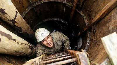
Wire hole, Hole #301 (1973) at the Oak Island Money Pit (AI-assisted historical reconstruction, not a photograph)
Borehole Era III, The Machine Age Triton / Bowmaster 1969-70 Not placed on the map 1 artifact

Wire hole, Hole #301 (1973)

Drilled 1973 by Triton Alliance, 113 ft

Depth113 ft
As reported by the source
Year1973
ByTriton Alliance
WhereAbout 800 ft from the Money Pit (Blankenship); 660 ft north (Harris and MacPhie)
CampaignTriton drilling (1973)

Beach sand 60 to about 75 ft, the only beach sand Blankenship saw in the till; wood from about 85; wire in a solid clay core at 95 (Stelco: made 1500 to 1800); iron plate struck at 97 to 98; abandoned about 15 ft deeper in tight clay. The Triton Shaft was sunk here.

No public source gives this hole's position.

What the Drill Found

  1. 0 ft
    SurfaceTop of the hole
  2. 60 to 75 ft
    Soil / clayRounded, homogeneous sand like beach sand in the till; some rock pieces water-stained on one face, as if from a wall
    Dan Blankenship (Mar 1973)
  3. 95 ft
    MetalSmall piece of wire in a solid clay core (Stelco: made between 1500 and 1800)
    Stelco (A.B. Dove)
    Harris and MacPhie give the wire at 110 ft.
    Dan Blankenship (Jun and Sep 1973)
    Drawn wire at 110 ft (Triton borehole, 1973) →
  4. 97 to 98 ft
    MetalIron plate struck; the bit pierced it and came up with its back edge deeply cut
    Dan Blankenship (Sep 1973)
  5. 110 ft
    MetalPiece of wire
    Triton Alliance (1973)
    Drawn wire at 110 ft (Triton borehole, 1973) →
  6. 113 ft
    BottomWhere the hole stopped, as reported by the source

Rows are in depth order; the column on the left is the hole, and a figure between rows is the stretch with nothing logged. Depths as reported by each source.


Sources

  • Drilled by Triton Alliance (Dan Blankenship; Lester Veinotte drill, then Keystone churn drill)
  • Blankenship reports (1965-94) p72-79; Harris and MacPhie (2013) p110
  • Blankenship reports (1965-94) p73
  • Blankenship reports (1965-94) p77-78
  • Blankenship reports (1965-94) p78
  • Harris and MacPhie, Oak Island and its Lost Treasure, 3rd ed. (2013); scan p110
  • Positions and depths: see how we know this on the Money Pit Map.