A Triangle at the Centre of the Island
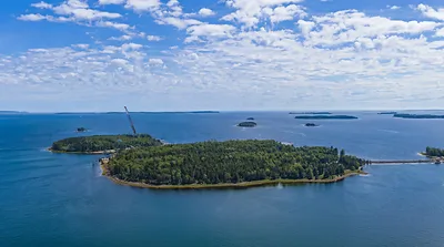
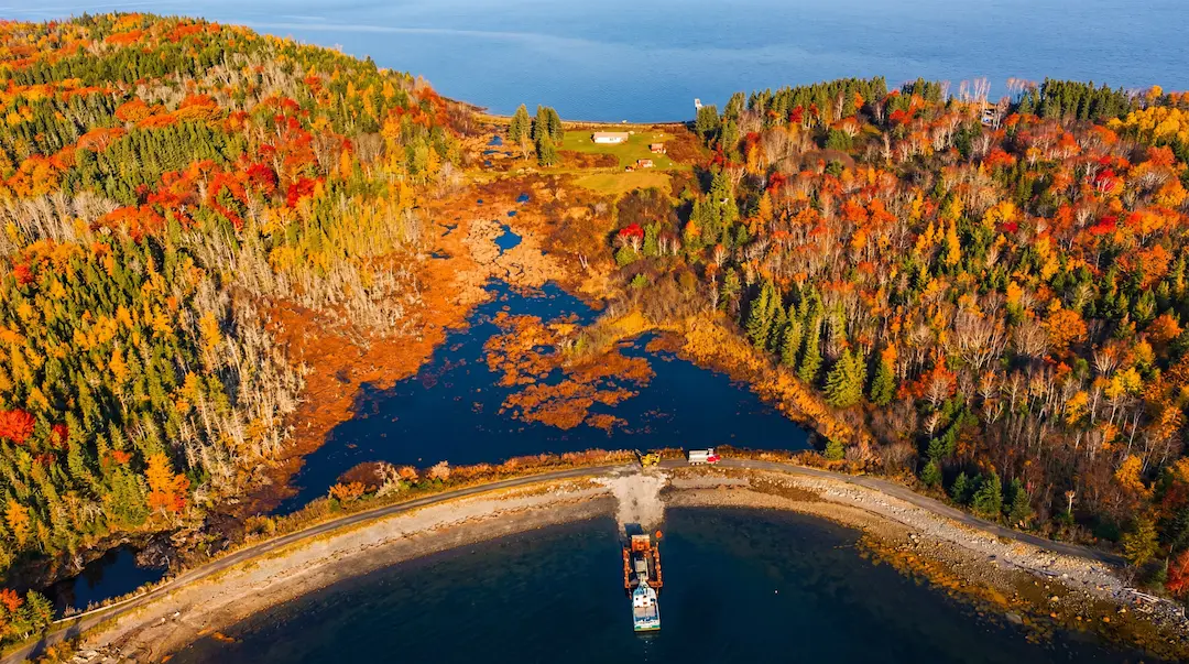
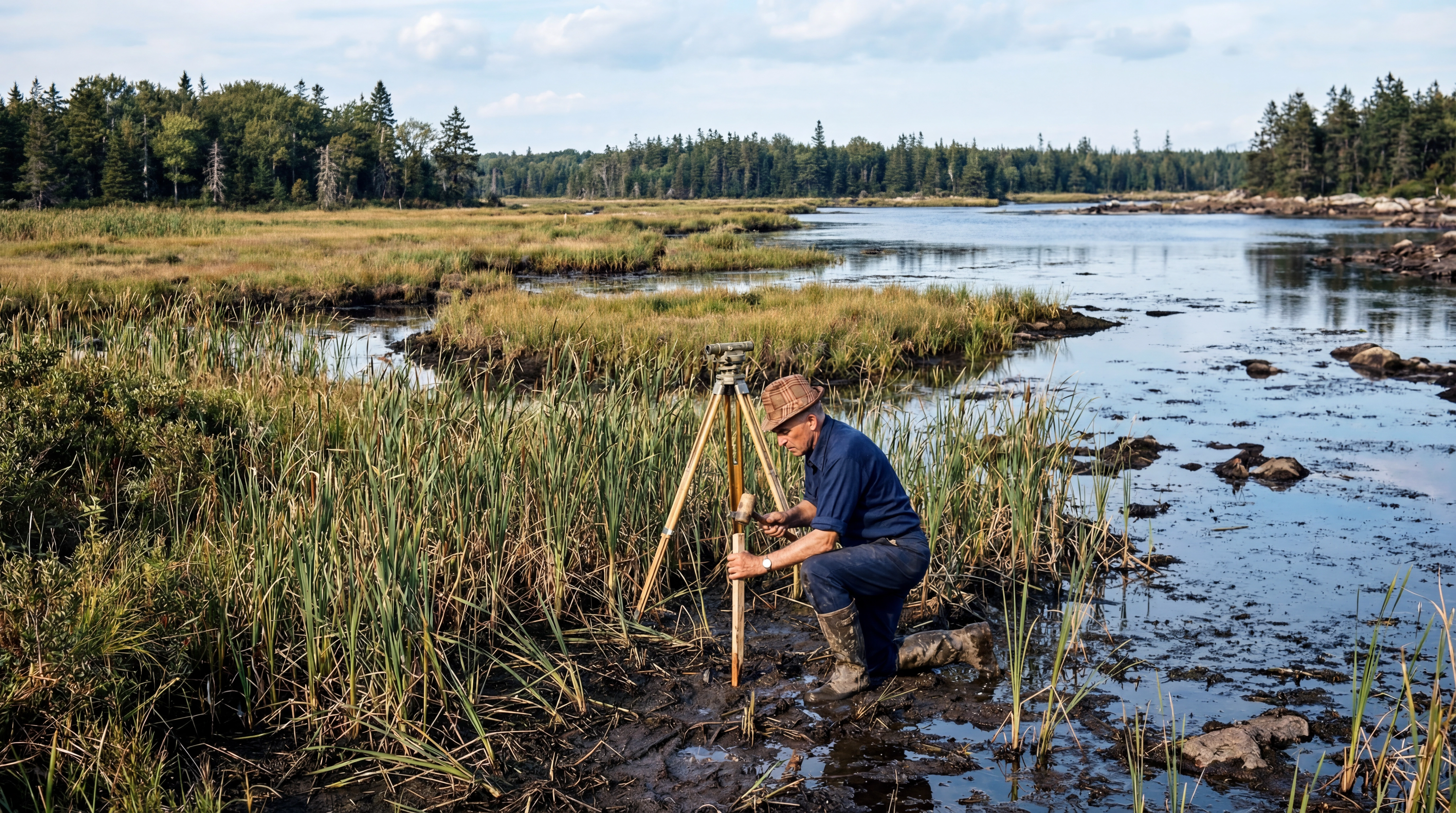
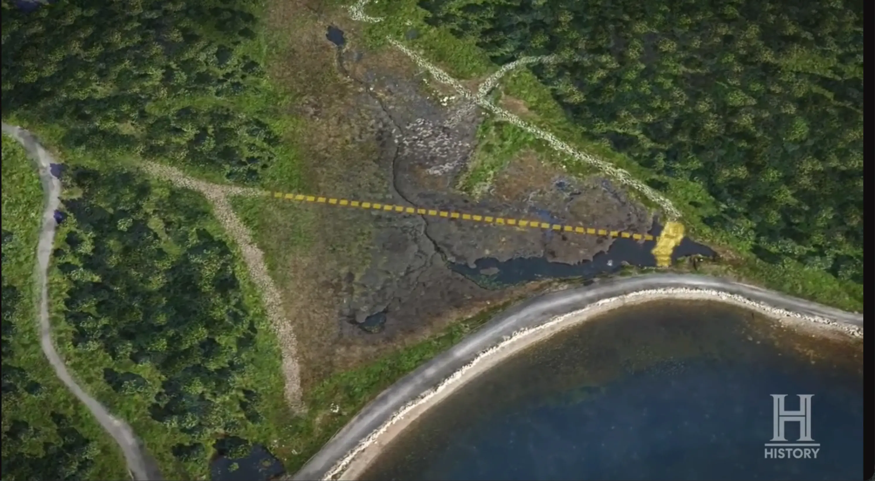
Seen from the air, the swamp at the centre of Oak Island forms a near-perfect triangle, its apex pointing north and its base running roughly east to west. The feature covers approximately 4.5 acres of brackish water, peat, and dense vegetation, sitting between the Money Pit area to the east and the western lots where 18th- and 19th-century settlers once farmed. For most of the island's treasure-hunting history, the swamp was treated as an obstacle, something to be crossed or avoided. That view began to change when surveyor and landowner Fred Nolan spent decades investigating it, and it changed permanently when the Lagina brothers and their team committed heavy equipment and scientific resources to draining and excavating the bog beginning in Season 7.
What they found beneath the murky water and peat has produced some of the most compelling physical evidence on Oak Island: stone roads, wooden survey stakes, ship timbers, a paved work surface dated to the medieval period, and a constellation of artifacts that span at least 800 years. Dr. Ian Spooner, an environmental geoscientist at Acadia University who has studied the swamp since 2019, has compared it to a highway running across the island. As of Season 13, the team estimates they have explored only about 30 percent of it.
 The Swamp→
The Case for Human Construction
The question of whether the swamp formed naturally or was deliberately created has been central to Oak Island research since at least the 1960s. Dan Blankenship, who devoted more than 50 years to the island, told the Lagina team in Season 1 that the most significant thing he and Fred Nolan had found in the swamp were the stumps of old oak trees. Oak trees cannot grow in standing water, and their presence beneath the surface suggested the area had once been dry land. In Season 2, a local tree expert identified a large stump pulled from the swamp as hardwood that could not have grown while fully submerged, meaning the swamp formed around and above the tree after it was established. Carbon dating placed the stump between 1450 and 1640 AD.
Fred Nolan advanced a related theory over several decades. He believed Oak Island had originally been two separate islands, and that at some point someone sailed a ship between them, allowed it to founder and sink, then joined the two landmasses by constructing what became the swamp. The theory held that this was done by building a cofferdam along the perimeter, excavating a vault or tunnel network underneath, burying something of value, and flooding the area with thousands of gallons of brackish water to make access virtually impossible. Nolan's 1969 drainage of the swamp recovered wooden scuppers and part of a mast from a large sailing vessel, evidence he cited for the rest of his life.
The scientific case for human construction took a major step forward in Season 7, when Dr. Ian Spooner analysed core samples and determined that the swamp is far younger than expected, perhaps only 300 to 400 years old. His sedimentation analysis showed that every centimetre of sediment corresponded to roughly ten years. A twig recovered from a deeper core level dated to approximately 1220 AD, suggesting the swamp itself may have been initiated around that time. In Season 7, Episode 13, Spooner delivered what Rick Lagina called the smoking gun: wood crushed beneath the stones of the paved area proved that a glacier could not have deposited the rocks, since no trees existed during glacial periods. He declared the feature man-made and predating the Money Pit's discovery in 1795.
Fred Nolan's Five Decades
No one spent more time investigating the swamp than Fred Nolan. A professional land surveyor who first came to Oak Island in 1958, Nolan purchased eight lots across the centre of the island in the early 1960s after M.R. Chappell denied him access to the Money Pit. His property included the swamp, which became the focus of his research for the next half century.
During his 1969 drainage operation, Nolan discovered uniform lines of wooden stakes beneath the swamp floor. As a surveyor, he recognized them as layout markers, the kind used to plan and construct a large feature. Carbon dating placed some of these stakes as far back as the 1500s. He also found two large ringbolts embedded in boulders on the eastern edge of the swamp, and described a timbered wall between the swamp and the beach on the north side: sawn square timbers stacked one atop another, extending down 12 feet and spanning approximately 12 feet in width. If confirmed, such a structure would represent strong evidence that the swamp was artificially contained.
Nolan also pursued the story of a "mystery box" or vault that Jack Adams, a 1930s island caretaker, claimed was buried beneath the swamp. Bobby Restall referenced the same story in his handwritten journals before his death in 1965. Nolan never found it, but ground-penetrating radar scanning in Season 2 revealed a large flat surface with dipping reflectors cutting through it, an anomaly inconsistent with the natural swamp bottom. Whether this represents the mystery box, an entrance to an underground vault, or something else entirely remains unknown.
When Nolan died in 2016, his son Tom joined the Lagina team as a full-time member, uniting all major Oak Island landowners for the first time in nearly half a century. Tom granted full access to his father's property and produced Fred's survey maps, representing 50 years of fieldwork that charted virtually every visible rock, survey line, and point of interest across the property. The maps had no legend, scale, or compass orientation, making interpretation difficult without Fred to guide them. Tom has repeatedly confirmed that specific structures uncovered in the swamp, including the paved area and the brick-and-slate vault, were not built by his father.
 Fred Nolan, the Oak Island Surveyor→
The Paved Area
One of the most significant discoveries in the swamp is a massive stone-paved surface located toward its centre. Diver Tony Sampson first identified flat stones with uniform surfaces during zero-visibility dives in Season 7, cutting across the natural geological grain rather than running parallel to it. He deployed buoys along the feature, and despite navigating blind, the markers surfaced in a remarkably straight line. Surveyor Steve Guptill's GPS overlay placed the structure at roughly 60 to 70 feet long and 12 feet wide, sitting precisely at sea level.
When the swamp was drained and the paved area fully exposed, geologist Terry Matheson noted the boulders near the surface were rock types he would not expect to encounter until approximately 120 feet down in the Money Pit area, suggesting they had been transported and placed. Archaeologist Laird Niven stated he could see no natural way for the rocks to have arrived at this location. Dr. Ian Spooner conducted the most detailed examination, observing that the stones were layered with small rocks on the bottom and larger rocks on top, consistent with road-building technique rather than glacial deposit. The feature was level, uniform, and as wide as a two-lane road. Spooner concluded he had worked in similar environments but never encountered anything like it.
Organic material recovered from directly beneath the stones was carbon dated to approximately 1200 AD. The dating places the feature squarely in the era of the Knights Templar, a connection that multiple researchers have explored.
Not all observers agree on the interpretation. Archaeologist Andre Costopoulos of the University of Alberta raised several alternative explanations in a 2020 analysis. He pointed to a photograph showing a stone platform Fred Nolan built in the swamp to support a coring rig, noting the colour and nature of the rock material appeared consistent with what the show was presenting as a much older feature. Costopoulos also suggested field-clearing as an alternative: settlers removing rocks from farmland and dumping them in the swamp was common practice in rocky Nova Scotia. A third possibility he raised was that the stones were laid as fill to dry a wet area or facilitate travel. Tom Nolan, however, stated on camera that his father did not have the means to create something on the scale of the paved area, and Spooner's analysis of the stratigraphy, particularly the crushed wood beneath the stones, appears to rule out glacial origin.
 Paved area / stone wharf→
The Eye of the Swamp
At the northernmost tip of the triangular swamp sits a small oval pond curiously devoid of vegetation. Aerial photographs dating back to the 1920s show that plant growth has never crept into this feature, a pattern Dr. Ian Spooner attributed to human intervention rather than any natural process. His team probed the bottom in 2019 and encountered rock around the perimeter, forming what appeared to be a circular stone formation.
In Season 7, Episode 3, Marty Lagina, Alex Lagina, metal detection expert Gary Drayton, and surveyor Steve Guptill took a boat into the pond to investigate. Gary waded in, at times up to his neck, and repeatedly hit iron with his pinpointer around the stones. Guptill mapped every contact point with GPS, and the results revealed a defined ring of rocks with iron readings at nearly every point. One stone carried no metal signature at all: a large, conical boulder with a flat edge on one side, resembling those that comprise the megalithic formation known as Nolan's Cross. Marty named the feature the "Eye of the Swamp," noting the symbolic connection to the all-seeing Eye of Providence, a symbol adopted by both the Knights Templar and the Freemasons.
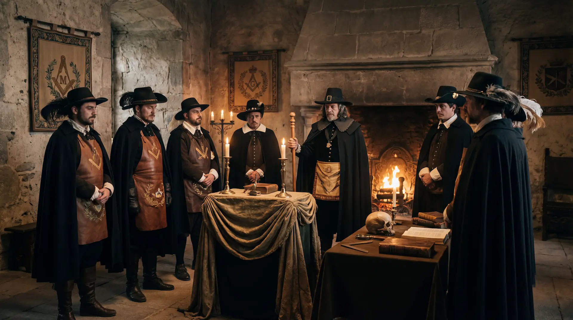 Freemasons on Oak Island, the Masonic Connection→
The Eye took on additional significance after researchers Corjan Mol and Chris Morford presented their theory connecting three paintings by 17th-century French master Nicolas Poussin to Oak Island. Poussin's second version of The Shepherds of Arcadia contains an embedded pentagram that, when superimposed on Nolan's Cross using the fifth boulder as an anchor point, places the centre of the geometric figure directly on the Eye of the Swamp. In a subsequent presentation, Mol and Morford demonstrated that the shepherd's pointed finger in the painting falls on the same location. Marty acknowledged the geometric elegance of the theory while noting the Eye was the hardest spot on the island to excavate.
 Sticks/organic matter (Eye of the Swamp)→
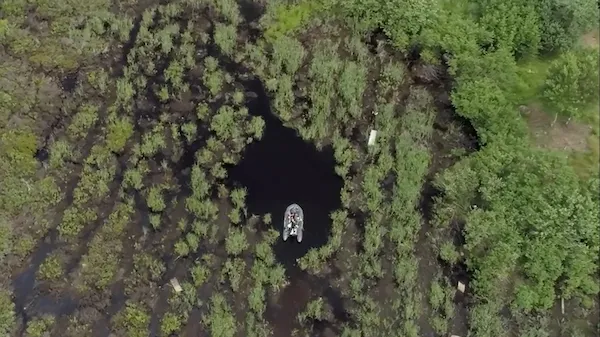 Eye of the Swamp→
The Arcadia Stone
When the team drained the Eye and began excavating in Season 7, Episode 16, they uncovered boulders as large as those forming Nolan's Cross, stacked together with smaller angular stones beneath and no clay between layers. Blue clay packed onto a large stone at the base of the formation recalled the blue clay layer found at 40 feet in the Money Pit during the original excavation in 1804. The largest of these boulders, positioned at the heart of the formation that the Poussin pentagram had pointed to, became known to the team as the Arcadia Stone, named for the painting that led them to it. Tom Nolan noted that his father had never seen these stones and would have insisted they remain undisturbed. The team halted excavation and brought in Dr. Spooner, who concluded the formation was not natural: the stones had been deposited and filled in relatively quickly. Archaeologist Laird Niven added that the stratigraphy resembled filled-in cellars.
 Nicolas Poussin, Keeper of Secrets→
Vibra-core samples from the Eye produced some of the most striking dating results from the swamp. A sample from a disturbed zone of interlayered organic matter and glacial till dated to 1600 to 1700, and a twig from the same site dated to 1674 to 1778, leading Spooner to conclude with confidence that significant excavation and human activity took place at the Eye between 1680 and 1700. A twig from a second core at a deeper level dated to approximately 1220 AD, suggesting the feature may have origins in the medieval period. Core samples also revealed high levels of lead and mercury at the base, an anomalous finding that Spooner connected to significant human activity. The mercury was particularly intriguing: 17th-century philosopher Sir Francis Bacon described a method for preserving documents in sealed containers filled with mercury in his 1620 work Novum Organum.
 Francis Bacon's Secret Island→
In Season 12, the team returned to the Eye and uncovered a ramp-like structure of logs and cobblestone that appeared to point toward it. A tiny red glass bead recovered during this excavation was identified by artifact analyst Emma Culligan as Venetian in origin, with the red colouring dating to the early 1700s or late 1600s. Tom Nolan confirmed the structure was not built by his father. By the end of Season 12, the compiled dating placed the Eye between 1630 and 1680. In Season 13, archaeoastronomer Professor Adriano Gaspani applied stellar alignment analysis to the GPS coordinates of eight-sided survey stakes recovered near the swamp and found they divided into two groups, both sharing alignments with the star Deneb in the Cygnus constellation consistent with a 13th-century construction date, matching the alignments he had previously identified in Nolan's Cross.
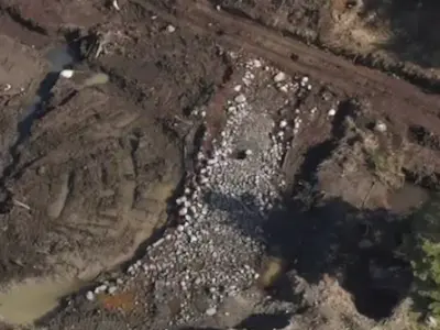
The Stone Road
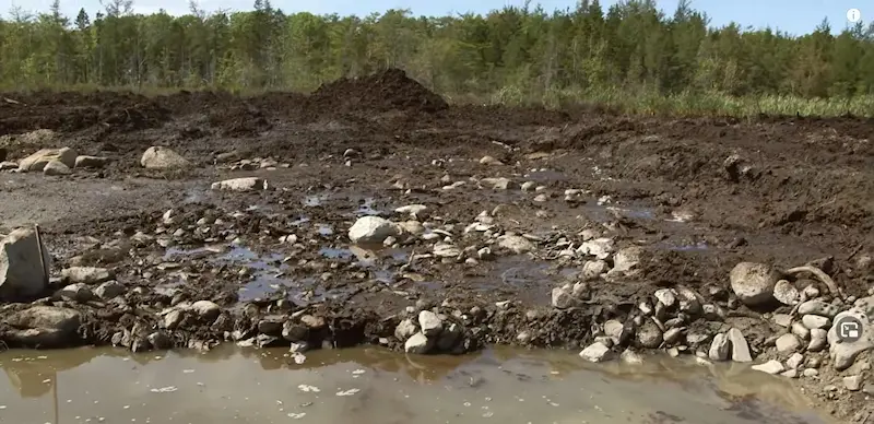
In the southeastern corner of the swamp, the team uncovered a massive stone road during Season 8 that would become one of the most extensively documented features on the island. Archaeologist Dr. Aaron Taylor identified wooden cribbing beneath the stone surface: beams running perpendicular and parallel in layered courses, forming an engineered substructure designed to prevent the stones from sinking into the swamp floor. The road was two to three courses of stone thick, approximately six feet wide, and built to a standard consistent with cart-track widths used across Europe for centuries.
By Season 8's end, surveyor Steve Guptill had measured approximately 460 feet of exposed cobblestone. The pathway continued to extend in subsequent seasons, and by Season 12 the total reached 600 feet across multiple connected sections. Beneath the road surface, the team found a second layer of stone supported by wood cribbing and cut stakes driven into the swamp floor. Woodchips from axe work were scattered throughout, confirming the road required significant labour, multiple workers, and a deliberate engineering system to distribute weight across boggy ground. Chunks of coal and charcoal also appeared among the stones, lending support to Fred Nolan's theory that a treasure galleon had been sailed into the area, unloaded, and burned.
Metal detection expert Gary Drayton recovered square ox shoe nails from between the cobblestones, confirming the road was once used by draft animals hauling heavy loads. The presence of ox shoe nails at both the swamp pathway and at the base of Nolan's Cross boulders raised the possibility that the same builders were responsible for both features. Other artifacts recovered along the road included an iron ringbolt that blacksmithing expert Carmen Legge dated to between the 1600s and 1760, keg barrel fragments, a leather strap, red earthenware pottery that archaeologist Aaron Taylor connected to the earliest European presence in Nova Scotia (potentially 1604 or earlier with possible Spanish or Portuguese origins), and annular ware dating to the 1750s.
The road's construction style drew particular attention from historian Terry Deveau, former president of the New England Antiquities Research Association. After visiting the site in Season 8, Deveau concluded the technology did not match French or British colonial roadbuilding practices seen in Nova Scotia over the previous 400 years. In his view, the road reflected a European building tradition from the 1500s or earlier. When the team visited Portugal with researcher Corjan Mol in Season 9, they found roads at Alqueidao da Serra that appeared remarkably similar in construction to the one at the bottom of the Oak Island swamp. Rick Lagina confirmed the match, and the team also found that offshore boulders near the swamp lined up with the stone road, suggesting it may once have extended into a stone dock.
Work along the stone road was temporarily halted in Season 9 when archaeologist Laird Niven discovered Mi'kmaq pottery in the area, estimated at 500 to 2,500 years old. All activity along the eastern border of the swamp ceased until the Mi'kmaq Rights Initiative and the Department of Communities, Culture, and Heritage could assess the site. Niven did not believe the stone road was constructed by the Mi'kmaq, but the presence of Indigenous pottery in the same area added another layer to the swamp's complex history.
 Stone Road→
..and the Sand Road
In Season 13, excavation of a freshly permitted area in the southwest corner of the swamp revealed a second road feature: a cobblestone surface covered by a layer of sand, lined on both sides by wooden survey stakes. Rick Lagina, Peter Fornetti, and Billy Gerhardt uncovered paired sets of five-sided and eight-sided stakes positioned together, the first time both types had been found side by side. Rick paced 21 feet between the first two sets, predicted a third at the same interval, and found one at the predicted location. The alignment ran northwest toward the centre of the swamp. In a subsequent dig, Gary Drayton recovered an ox shoe buried roughly a foot below the surface of the road, consistent with draft animals hauling materials along the route. As Billy traced the feature to the edge of the permitted dig area, the road appeared to head toward Center Road, the property boundary line drawn by Surveyor General Charles Morris in 1762. Craig Tester raised the possibility that the sand road predates the survey, and Peter noted that a route linking Lot 5 to the Money Pit would explain the connection between the two sites. The discovery added a third road type in the western swamp, alongside the corduroy road found earlier that season, and suggested an interconnected transportation network built across the bog.
 Sand Road (Western Swamp)→
The Brick-and-Slate Vault
In the northern section of the swamp during Season 12, the team uncovered a square structure composed of handmade brick and cut slate, unlike any feature previously encountered on the island. The discovery came while Alex Lagina, Craig Tester, and Billy Gerhardt were following a cobblestone pathway lined with eight-sided wooden survey stakes. Dr. Ian Spooner examined the bricks and judged them handmade. Archaeologist Laird Niven noted the structure's shape was different from the two round wells found on the Anthony Graves property, and Tom Nolan said he had never encountered anything like it.
Excavation of the vault produced a wrought iron hook that Tom suggested was used to lower or remove items from the structure. Katya Drayton's metal detector registered signals within, and the team recovered a lead counterweight end, fragments of blue-glazed and yellow ware pottery, and iron pipe. When drained and dug to the bottom, the vault itself was empty. Rick Lagina connected the feature to Anthony Graves, who purchased most of Oak Island in 1857, built his home near Joudrey's Cove just north of the swamp, and was said to have made purchases on the mainland using Spanish silver coins.
Laboratory analysis placed the vault's bricks in a different category from those found at Lot 5 and Smith's Cove. X-ray diffraction showed that the Lot 5 and Smith's Cove bricks were similar in composition and matched samples from Brick Hill, a local kiln operating in the 1600s. The swamp vault bricks, by contrast, aligned more closely with other local samples from the 1800s. The compiled dating for Season 12 placed the vault in the late 1600s based on its association with the surrounding cobblestone path (stakes dated 1650 to 1700) and other features in the northern swamp. A second possible vault was indicated in Season 13 when excavation in the same area exposed a stone structure at least three rocks thick built on top of swamp peat, with bricks resembling those from the first vault recovered nearby.
The Ship Anomaly and Maritime Evidence
A seismic survey conducted at the end of Season 6, in which more than 2,000 explosive charges were detonated across the swamp, revealed a 200-foot-long anomaly roughly 25 feet wide, sitting between 15 and 55 feet below sea level. Its shape was consistent with a large ship, and the discovery revived Fred Nolan's long-standing theory that a vessel had been deliberately scuttled in the swamp.
Core drilling into the anomaly during Season 7 produced unexpected results. The organic layer proved remarkably thin, giving way almost immediately to hard, dry clay similar to what is found in the Money Pit area. At roughly 21 feet the clay was bone dry, and at approximately 29 feet the drill encountered a rock-like cap layer so dense it reached the point of refusal. Later cores drilled at 54 to 57 feet returned no wood, ruling out a sunken vessel at that location. The dry clay raised a new possibility: the conditions were ideal for tunnelling, and the anomaly may represent a buried passage rather than a ship.
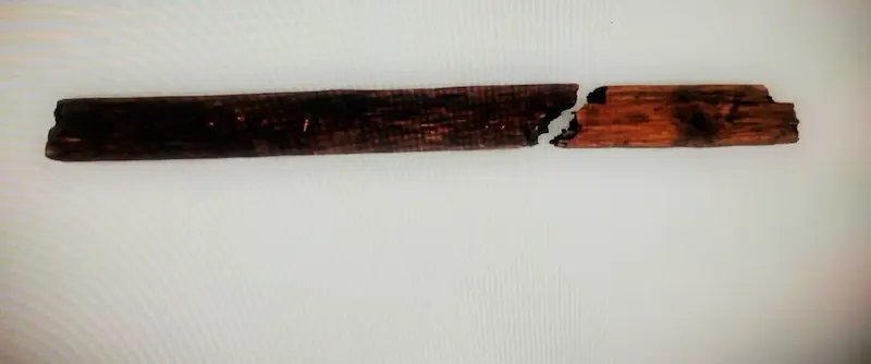
Maritime artifacts have nonetheless accumulated steadily from the swamp. An 18-foot-long wooden plank recovered by diver Tony Sampson from just below the surface was identified as deck or side planking from a masted ship and carbon dated to between 1680 and 1735. An iron spike found in the swamp was identified by antiques expert Dr. Lori Verderame as an aburro-dade type wrought iron spike from a Spanish galleon, comparable to examples recovered along Florida's Treasure Coast, and dated to the same general period as the 1652 Spanish maravedi coin found in the swamp during Season 1. A ship's railing recovered from ten feet below sea level during Season 8 was carbon dated to 660 to 770 AD, making it the oldest artifact found on Oak Island at that time. Shaped wood found within 30 feet of the railing in Season 9 dated to 224 to 376 AD.
In Season 13, the team also discovered a corduroy road in the western region of the swamp: cut logs with peeled bark laid across clay with rocks underneath, a transportation method first designed in Europe during the 11th century for moving wagons and heavy cargo across marshy terrain. Coal or charcoal recovered from this area matched samples previously found along the stone road and the cobblestone path, suggesting a connection between all these features.
 Wooden ship's railing→
Other Finds
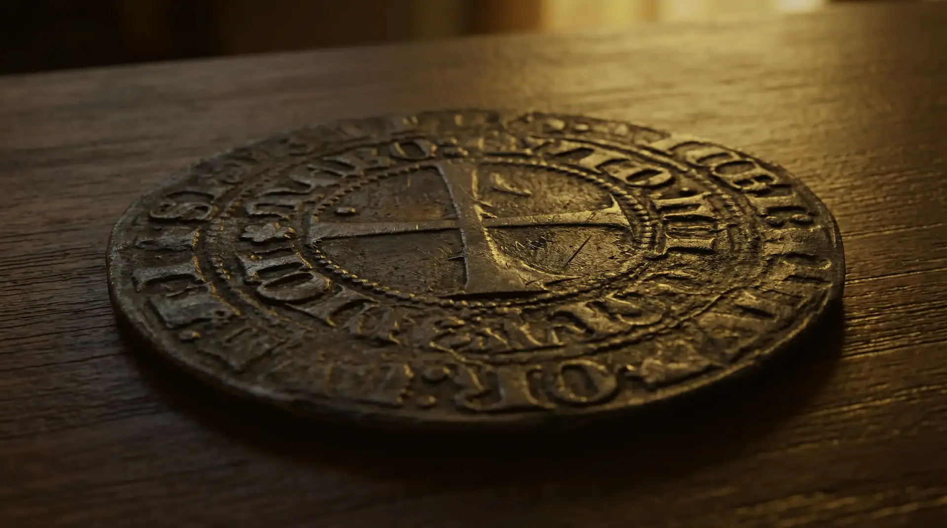
The swamp has produced a wide range of artifacts beyond the major features. The 1652 Spanish maravedi coin, discovered in the final episode of Season 1 after the swamp was partially drained, was the find that persuaded Marty Lagina to continue the search. Cleaned by Global Marine Exploration in Tampa, the coin's date placed activity on the island more than 140 years before the Money Pit's discovery. Porcelain fragments recovered from the swamp during Season 7 were dated to 1674 to 1700.
Near the Eye of the Swamp, Gary Drayton and Jack Begley recovered an iron pickax with unusually short tines suited for tunnelling rather than surface work, along with a round-point spade. Carmen Legge dated the pickax to the mid-18th century. A hand-forged iron strap found along the stone pathway was identified by Legge as a brace from a nine-inch-diameter ship's timber dating to 1710 to 1790, with clear evidence of burning. Doug Crowell discovered a metal artifact in Dan Blankenship's archived files labelled as having been found in the swamp in the 1970s; Carmen Legge identified it as part of a large cannon and dated it to the mid-1400s. In Season 13, a hand cannon from the same archive was confirmed by both lab analysis and a military historian as potentially dating to the 1200s.
The Mercy Point, identified by Norwegian researcher Petter Amundsen using his theory that Nolan's Cross encodes the Kabbalistic Tree of Life, produced the season's strongest early metal detection readings. A Deepmax X6 survey showed nonferrous returns across multiple depth layers covering an area estimated at roughly 100 feet. Operator Dave Spencer's three-dimensional analysis revealed a target roughly 15 to 20 feet long and about three feet wide. When the team used caissons to isolate and drain the Mercy Point, they found nothing. The failure was a pivotal moment: it shifted the team's focus from the Mercy Point to the broader swamp, where the physical evidence would prove far more substantial.
 William Shakespeare, the Lost Works→
What the Swamp Tells Us
Taken together, the swamp evidence points to at least two distinct periods of significant human activity on Oak Island. The first cluster falls in the 13th century: the paved area's organic underlayer dated to approximately 1200 AD, Professor Gaspani's archaeoastronomical dating of the swamp stakes and Nolan's Cross to the same period, and the hand cannon potentially from the 1200s. The second cluster falls in the 1600s and early 1700s: the Eye of the Swamp activity dated to 1680 to 1700, the cobblestone path stakes dated to 1650 to 1700, the brick-and-slate vault from the late 1600s, the deck plank from 1680 to 1735, and the 1652 maravedi coin. This pattern mirrors what has been found in the Money Pit area, where wood from borehole FG-12 at 106 feet was carbon dated to 1626 to 1680.
The convergence of dates between the swamp and the Money Pit represents one of the strongest lines of evidence that the two areas are connected. As Doug Crowell observed in the Season 9 finale, the swamp functions as a time capsule, preserving wood dated to more than a thousand years old alongside 17th-century pieces. Steve Guptill's mapping of every cobble section, survey stake, and structural feature has begun to reveal an interconnected system: the cobblestone path connects to the Eye of the Swamp and the wooden platform, projects toward the brick vault, and extends via the stone road toward the Money Pit.
What cannot yet be established is who built these features, what exactly they were transporting, or whether the swamp conceals something that has not yet been reached. The ship anomaly remains unexplained despite core drilling that ruled out a vessel at the tested depth. The paved area's 1200 AD dating has not been independently replicated. The vault was empty when excavated. And roughly 70 to 80 percent of the swamp has never been investigated. Dr. Spooner's characterisation of the swamp as a highway across the island may prove to be the most useful framework for understanding it: not a single feature or a single event, but an infrastructure built and used across centuries by people whose identity and purpose remain, for now, beyond the reach of the evidence.
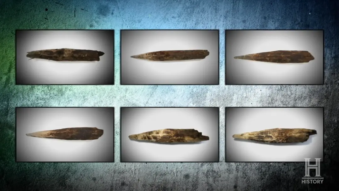 Wooden Stakes→