
Oak Island Artifacts Dated: The Complete Chronological Timeline
A chronological map of hundreds of dated Oak Island artifacts across a thousand years, from the m...

Drilled 1969 by W. Bowmaster with Warnock Hersey, 219 ft
Gypsum at 165; wood from 192, cored 192 to 197 (red brick-like clay on the bit; driller judged over 4 ft of solid wood); cased to 196; cavity 200 to 206 with stagnant, discoloured water; soft gypsum to 219. Kept as a pumping hole. Probably the hole Golder calls Borehole 11A ('also referred to as Borehole 24'), cased to about 198 ft and ending in a cavity; identity not certain.
Positions on the map are approximate; each dot marks the top of the hole.
Rows are in depth order; the column on the left is the hole, and a figure between rows is the stretch with nothing logged. Depths as reported by each source.




As an Amazon Associate I earn from qualifying purchases.
A chronological map of hundreds of dated Oak Island artifacts across a thousand years, from the m...
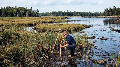
Fred Nolan surveyed every inch of Oak Island, bought a quarter of it for $2,500, and spent 58 yea...

Captain Kidd, Blackbeard, Easton, Black Bart, Anderson. Oak Island sits in Mahone Bay, a document...