Colour shows who drilled, a square marks a caisson, a gold ring a hole with artifacts. Zoomed out, the map shows the landmarks; zoom in for the full grid. Pick an era on the timeline to see one chapter of the search, open Layers for tunnels and workings, and tap anything for its record.
Around the Money Pit the drill logs record more than soil and rock: 99 hit wood, 48 broke into a cavity, 67 brought up metal, 46 hit a possible tunnel, and 86 artifacts in the vault are traced to 43 holes.
1795190019602006today
Positions: MacPhie (2008), Hamilton (1939), Dunfield (1965), the S13E07 grid plan and the episodes, approximate. Imagery: Esri, Vantor, June 2025, about 5 m.
Four Eras of Digging
Who Dug, and When
Every hole on record, in four chapters. Open one to see its campaigns and holes, the most revealing first; tap a hole to open its record on the map.
IPick and Shovel1795 to 1899Hand-dug shafts chasing the flooded pit, from the first dig in 1795 to the Treasure Company's drill holes of 1897.28 holesdeepest 188 ft6 on the map23 artifacts▾
IIThe Companies1900 to 1959Drilling rigs and bigger shafts: Bowdoin's cores, the Chappell and Hedden shafts, Hamilton's tunnels and the Greene and Harman holes.51 holesdeepest 190 ft2 on the map6 artifacts▾
IIIThe Machine Age1960 to 2005Heavy machinery and engineers: Dunfield's excavation, the Becker drilling, the Warnock Hersey and Golder studies, and Borehole 10-X.92 holesdeepest 590 ft65 on the map20 artifacts▾
Johnson drill-holes (1962)Dunfield drilling (1966)Becker drilling (1967) · 49 holesWarnock Hersey drilling (1969) · 9 holes10-X pumping holes (1970-93)Golder Associates drilling (1970) · 8 holesTriton drilling (1973) · 5 holesMoney Pit large-diameter holes (1975-76) · 4 holesHoles west of the Cave-In Pit (1976-77) · 3 holesOak Island Detection Program holes (1993) · 5 holesNoon Star drilling (1999, 2001) · 40 holes
IVThe Show2006 onThe present search, filmed for The Curse of Oak Island: the Garden Shaft, H-8 and the grid of boreholes and caissons around the Money Pit.196 holesdeepest 233 ft158 on the map35 artifacts▾
How we know this: sources and method
Positions
Positions of the older holes come from Les MacPhie's 2008 technical report, read from his Figures 3, 6 and 7 and checked against distances in the other reports. Holes drilled for the show are placed from their names and the distances given in the episodes. All positions are approximate. Each dot marks the top of the hole; many were drilled at an angle.
Tunnels and Workings
The 21 lines and areas on the map are drawn by how well the record fixes them. Recorded shapes were surveyed or measured by the people who dug or found them (the shaft outlines and solution channel from the S13E07 grid plan). Approximate shapes are placed from distances and directions in a report or sketch: Dunfield's excavation from MacPhie's 2008 figures, Hamilton's tunnels from his 1939 report, the drains from Dunfield's 1965 field sketch. Conjectural lines join the points the record gives without knowing the course between them: the alleged flood tunnel, and tunnels known only from the holes that cut them. Each record names its sources.
Depths
Post-1966 ground: measured after Robert Dunfield lowered the Money Pit area by about 10 ft (MacPhie 2008, Golder, Warnock Hersey).
Original ground: measured from the surface before 1966 (Harris and MacPhie give the Becker depths this way).
Anything else is as the source reports it. A hole's depth is the deepest point any source records for it.
Reports Used
Les MacPhie, The Money Pit: Geotechnical and Archaeological Conditions and the 1967 Becker Drilling Results (2008)
Golder Associates, Subsurface Investigation, The Oak Island Exploration, draft report (1971)
Warnock Hersey International, Soils Investigation, Oak Island (1969), with J.C. Osler's review (1970)
Dan Blankenship, periodic reports 1965 to 1994, compiled by Les MacPhie (2016)
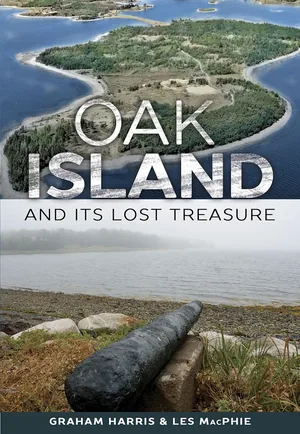
Graham Harris and Les MacPhie, Oak Island and its Lost Treasure, 3rd ed. (2013)
Erwin Hamilton, Work Carried On at Oak Island (Summer 1939), typescript, and his sketch of the Money Pit shafts
Robert Dunfield, Field Sketch of Drain System, Smith's Cove, 25 July 1965
The Curse of Oak Island, History Channel, for holes drilled from 2006 on
Imagery
Esri World Imagery (Vantor, June 2025, 0.34 m per pixel, stated accuracy about 5 m). The photo is sharp to zoom 18; beyond that it fades so the holes stay readable. Dots may sit a few metres off today's features in the photo.