A Line Across the World
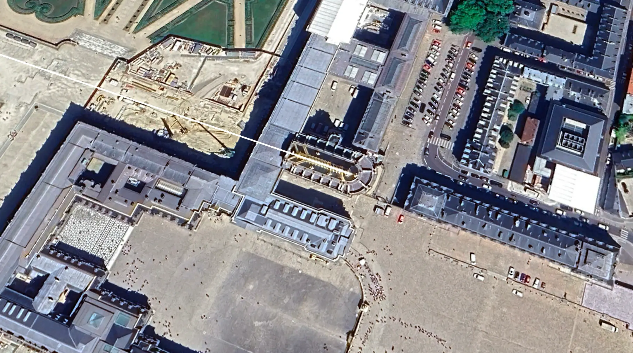
Stretching out from the central gates of the Palace of Versailles is a three-mile axis that bisects the royal gardens. Avenues converge at perfect sixty-degree angles. Fountains and canals extend toward the horizon in rigid symmetry. Every stone, every path, every sightline was placed under the watchful eye of Louis XIV, the Sun King. For more than three centuries, visitors have marveled at the scale and beauty of Versailles without ever realizing what is hidden in its design.
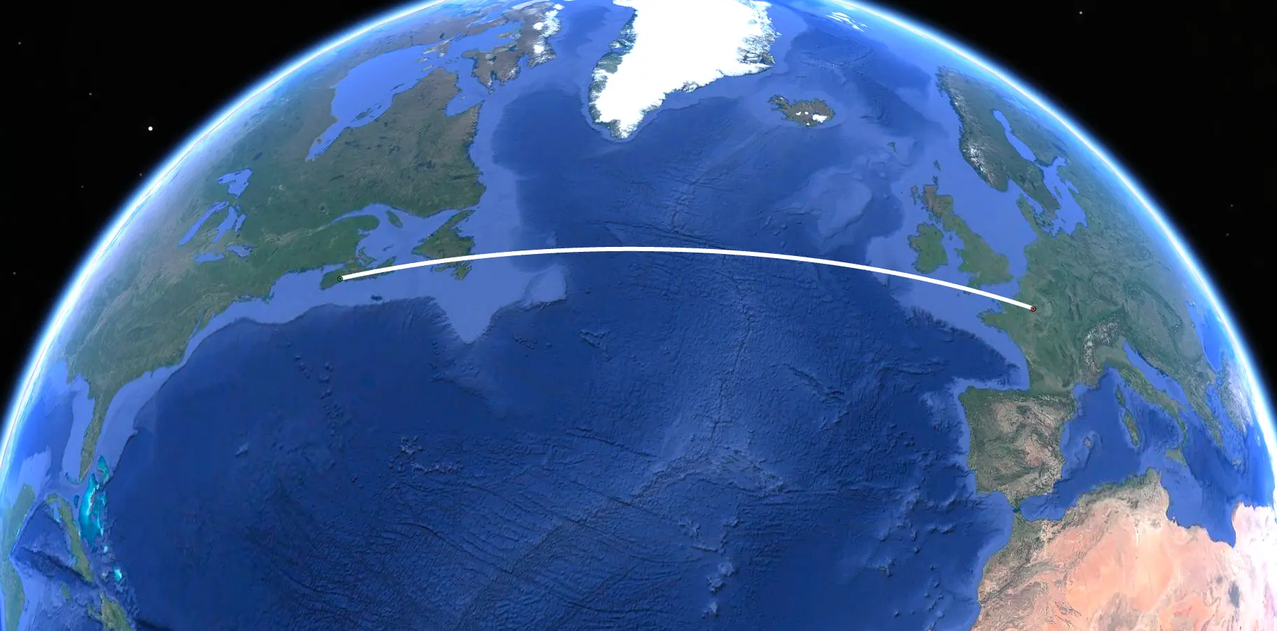
In 2020, researchers Corjan Mol and Chris Morford presented a theory on Season 8, Episode 4 ("Alignment") of The Curse of Oak Island that revealed something extraordinary concealed in the layout of the royal gardens: a giant menorah, delineated on a truly massive scale, whose central axis points with remarkable precision to the Temple Mount in Jerusalem, the site of Solomon's Temple, where the original Menorah once stood. Extended in the opposite direction, that same axis crosses the Atlantic Ocean and reaches Nova Scotia, aligning with the megalithic formation on Oak Island known as Nolan's Cross.
If the alignment is intentional, it means that the builders of Versailles encoded a line connecting the place where the treasures of Solomon were kept with the place where they may ultimately have been hidden, and placed a three-mile representation of the Menorah itself at the midpoint.
Oak Island – Versailles Alignment
A KML file plotting the geometric alignment between Nolan's Cross on Oak Island and the gardens of Versailles. Open it in Google Earth to explore the connection in 3D.
Download KMLHow to open in Google Earth
Browser (no install)
Go to earth.google.com. Click the menu, then New > Open local KML file. Select the downloaded file.
Google Earth Pro (desktop)
Go to File > Open and select the KML file. The alignment loads into your Places panel.
Mobile
Install the Google Earth app. Tap the downloaded file from your device and it opens directly.
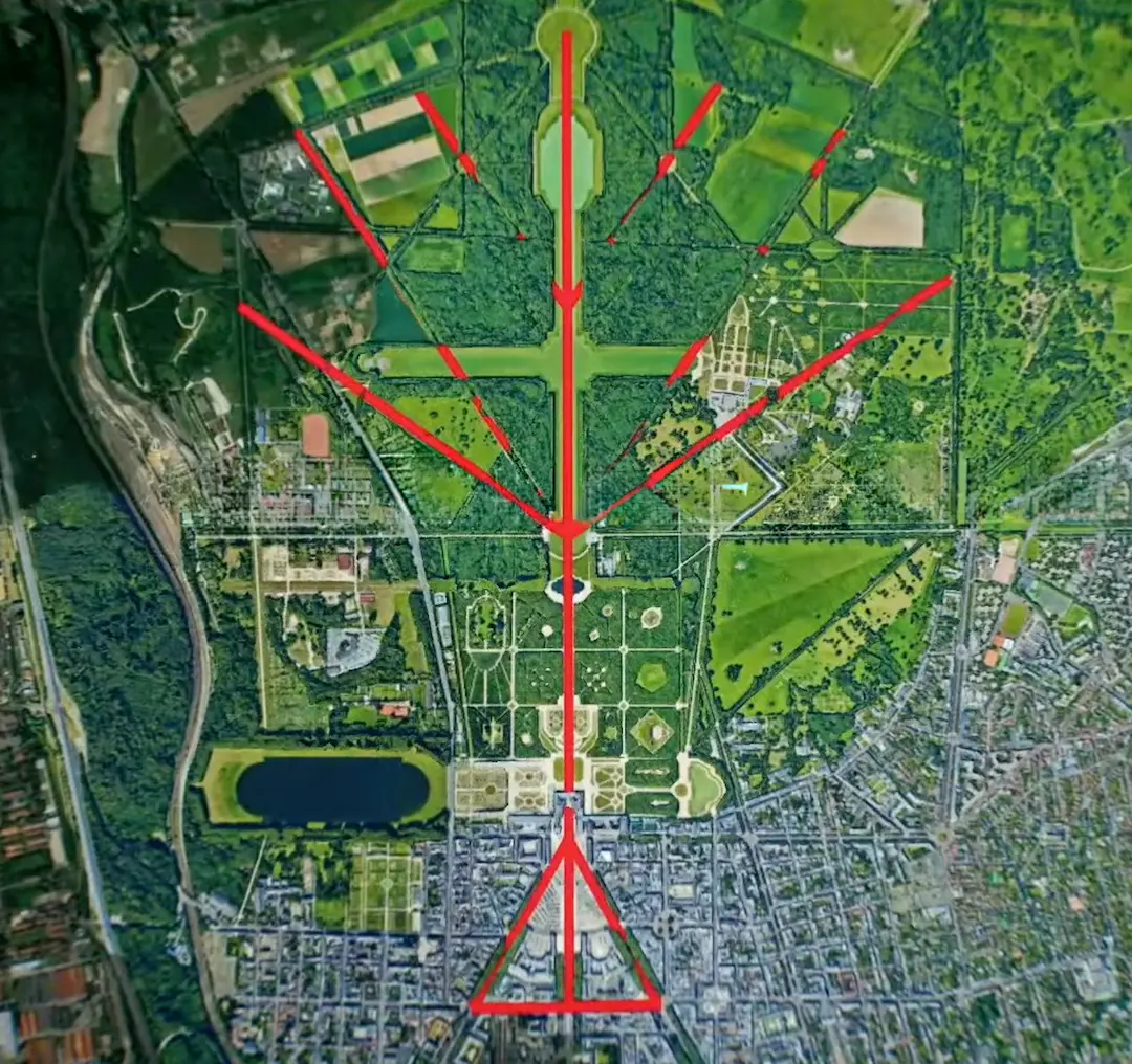
The Hidden Menorah
When viewed from above on a historical plan of the estate, the gardens of Versailles slowly reveal the shape of a seven-branched Menorah with straight arms, stretching across the full extent of the grounds. The palace building itself sits at the heart of the design, at the center of the central axis. From the east, three avenues converge to meet the main gate in a huge, perfect sixty-degree tripod. To the west, the gardens extend outward along the branches, with the Grand Canal forming a Latin cross at the center of the composition.
The straight-armed form of the Menorah depicted at Versailles is significant. It corresponds to the earliest known depictions of the Menorah and to the interpretation championed by Rabbi Maimonides in his twelfth-century work the Mishneh Torah, which argued that the original Menorah had straight arms rather than the curved form commonly shown today. Louis XIV possessed a copy of the Mishneh Torah, and it was translated into French in 1678 on the orders of his First Minister of State, Jean-Baptiste Colbert. It appeared that Louis and his inner circle shared the view that the straight-armed menorah was the original form and it was this version they embedded in the landscape of Versailles.
The early landscaping works were carried out by Jacques Boyceau and Claude Mollet, both of whom wrote extensive treatises on the use of sacred geometry and precise alignments in landscape design, documenting the scientific instruments they used to achieve such features. It was Boyceau who created the central axis of the gardens, first documented on the first map, the so-called Plan du Bus. These were men with both the knowledge and the tools to execute designs aligned across vast distances.
From Jerusalem to Oak Island
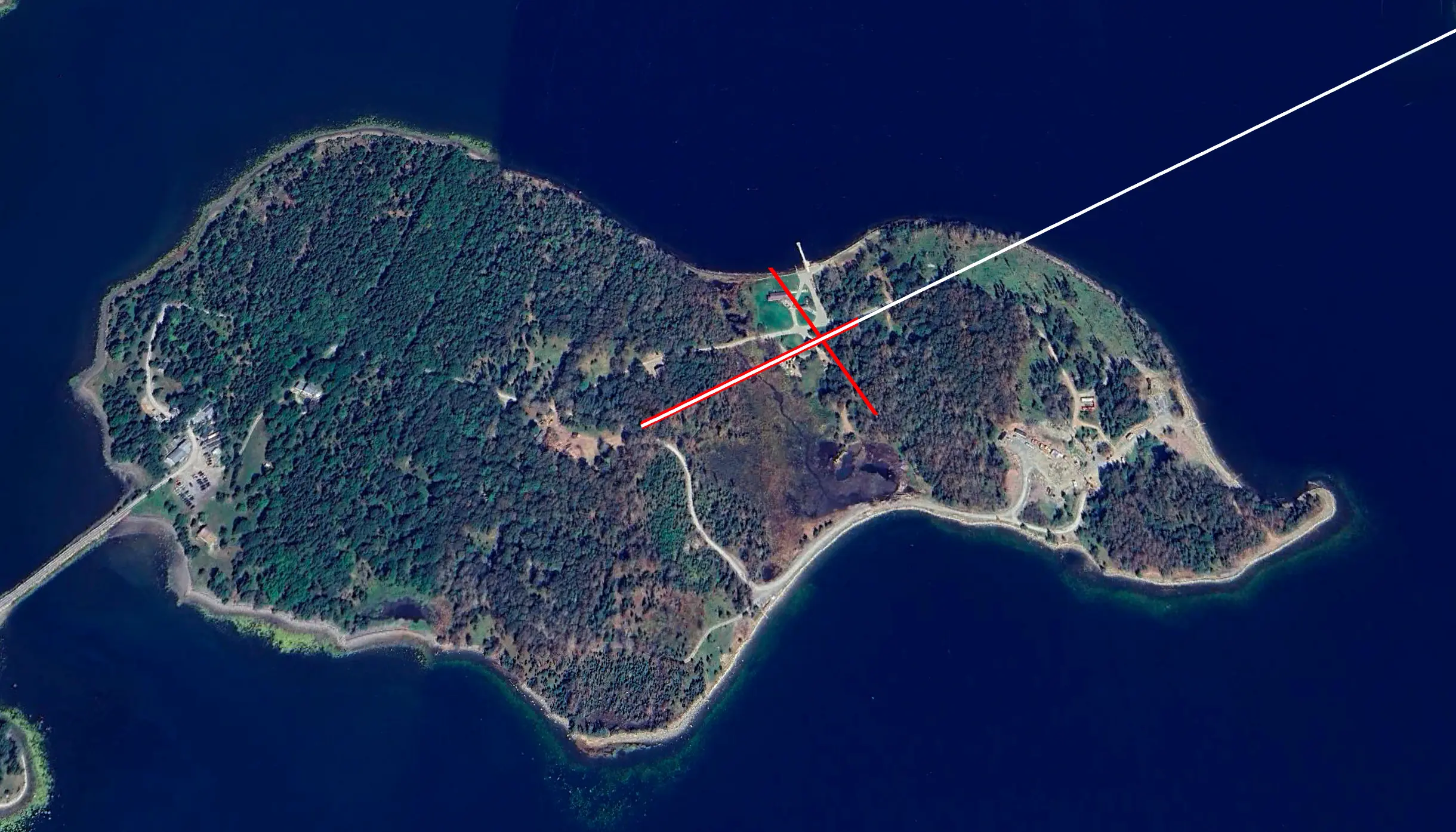
The initial inspiration to look for alignments at Versailles came from the late Oak Island researcher Chris Donah, a skilled amateur astronomer who suggested during a war room discussion that Nolan's Cross, the formation of five megalithic boulders on Oak Island discovered by Fred Nolan in 1981, might point toward the Temple Mount in Jerusalem. That segment never aired, but Mol and Morford continued to investigate, and they soon realized that the giant menorah they had mapped in the gardens at Versailles was pointing in exactly the same direction.
To validate their findings, Mol and Morford enlisted the help of Erin King, a geolocation and geographic information system expert and consultant on The Curse of Oak Island, who used industry-grade GIS software to verify the alignments. They also established rigorous criteria for their research: any alignment had to physically point from one place to another along a defined feature; the two locations had to be contextually connected; and the technology required to create the alignment had to have been available in the seventeenth century. The central axis of the Versailles Menorah met every test. To the East, it pointed with remarkable precision directly to the Temple Mount in Jerusalem, the very site where the Menorah had once illuminated the Holy of Holies in Solomon's Temple.
However, when they extended the line in the opposite direction, northwest across the Atlantic toward Nova Scotia, the alignment to Oak Island carried a deviation of approximately 0.7 degrees. Over a distance of more than three thousand miles, that small error translated to a variation of roughly twenty-five miles on the ground, too large to claim the alignment was intentional. Mol and Morford presented this caveat honestly when they first revealed the theory during Season 8 of the show. But the story did not end there.
The Royal Chapel
One of the defining features of Versailles is its symmetry. Louis XIV insisted that this aesthetic be adhered to religiously. Even the village of Versailles that bordered the palace had to expand symmetrically to retain the beauty of the surrounding area. The King had a term for this principle: "the royal symmetry."
It therefore came as a great surprise to his courtiers when, in 1687, Louis chose a location for his new Royal Chapel that violently broke the otherwise perfect symmetry of the palace. Multiple proposals had been rejected since 1685. The chapel that was finally built jutted out from the north wing like a sore thumb, becoming the tallest structure on the entire estate. Many in Louis' court deeply resented the decision, and no satisfactory explanation for the break from symmetry was ever offered, until Mol and Morford found one.
The Royal Chapel at Versailles aligns with extraordinary precision with the spine of Nolan's Cross on Oak Island. If you were to walk along the spine of the cross heading east, continuing across the floor of the Atlantic Ocean, you would eventually arrive at the altar of Louis XIV's chapel. The researchers concluded that the King had deliberately broken his own golden rule in order to correct an alignment that had been laid out imperfectly by his father, Louis XIII. He realigned his menorah to Oak Island, creating a dramatic new landmark at Versailles in the process.
Louis was explicit about the significance of this place of worship. Inside the chapel, sculpted on the wall beside the altar, is a menorah, closely resembling the form depicted next to Edward Despenser in the Tewkesbury Book of Founders and Benefactors. The chapel, it appears, declared its purpose in stone.
The Dark Origins of Versailles
The question of why this particular spot was chosen for the grandest palace in Europe has never been satisfactorily answered. In the sixteenth century, the land that would become Versailles was nothing more than an insignificant, swampy expanse of uncultivated ground. The air was said to be unpleasant and unhealthy due to numerous pools of stagnant water. Critics in the royal court endlessly questioned why the King would prefer this squalid marshland over the opulence of the Louvre and Tuileries palaces in Paris.
The property was first purchased in 1561 by Martial de Loménie, Secretary of State for Finance to King Charles IX. It was then acquired through sinister means by Albert de Gondi, an Italian from Tuscany who had embedded himself in the household of Catherine de Medici. During the religious wars between Catholics and Huguenot Protestants, de Loménie was arrested and imprisoned. While in his cell, he was visited by de Gondi and coerced into signing over the Versailles estate for a nominal sum. De Loménie believed the act had saved his life, but it was not to be, he was strangled in his prison cell on de Gondi's orders during the St Bartholomew's Day Massacre of 1572, with the approval of Catherine de Medici herself.
The de Gondi family secured the estate and became the dominant power in the region. The land eventually attracted the interest of King Henry IV, who brought his young son, the future Louis XIII, hunting there in 1607. Louis XIII built a hunting lodge on the site in 1623 and purchased the surrounding estate from Albert de Gondi's son in 1632. His own son, Louis XIV, inherited Versailles and transformed it into the palace that stands today. The conventional explanation is that Louis preferred the site because it offered room to build on a scale Paris could not accommodate. Mol and Morford argue a different reason: the site was chosen because it sat at the precise point from which the alignments connecting Jerusalem and Nova Scotia could be drawn.
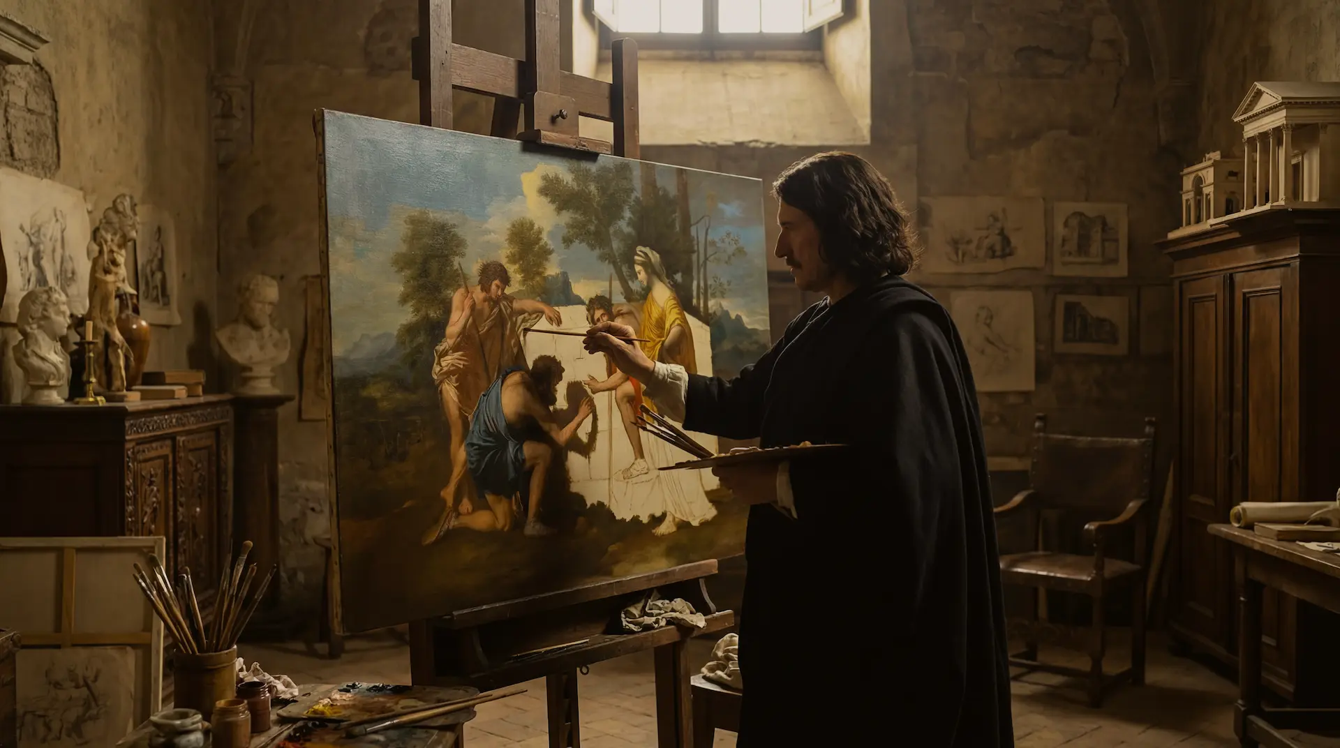
Poussin and the Great Secret
The man whose work first led Mol and Morford to the alignments is Nicolas Poussin, one of France's most celebrated Baroque painters and a figure deeply entwined with the mysteries of Versailles. In 1638, Poussin painted The Conquest of Jerusalem by Titus, depicting the sack of Solomon's Temple with the golden menorah clearly visible being carried away. Around the same time, he completed The Shepherds of Arcadia, a painting that would become central to one of the most enduring mysteries in European art and one of the most elaborate theoretical frameworks explored on the show.
In 1655, Nicolas Fouquet, the Superintendent of Finances and one of the most powerful men in France, sent his brother Louis to Rome to buy works of art. Louis Fouquet enlisted the help of Poussin, and the two men became closely acquainted. On April 17, 1656, Louis Fouquet wrote a now notorious letter to his brother Nicolas describing discussions with Poussin involving what appeared to be a great secret. The relevant passage reads: "He and I, we have projected certain things that I may discuss with you entirely in a short time, they will give you, through M. Poussin, advantages that kings would have great trouble taking from him, and after him maybe nobody in the world will ever recover in the centuries to come."
Mol and Morford argue this letter describes discussions about alignments and sacred geometry pointing to specific locations, both in France and beyond, the same coded knowledge that Poussin was embedding in his paintings. Shortly after Fouquet's arrest by Louis XIV in 1661, the King personally acquired Poussin's The Shepherds of Arcadia and had it displayed at Versailles.
 Nicolas Poussin, Keeper of Secrets→
A Grand Design
The Versailles Alignment does not rest on a single coincidence. A skeptic might argue that alignments can be found between any set of points on a globe, or that the menorah shape in the gardens is a product of seeing patterns in standard Baroque landscape design. These are reasonable objections. What makes the Versailles case harder to dismiss is the convergence: the shape is consistent with the Maimonides tradition that Louis XIV demonstrably studied; the axis to Jerusalem follows a defined architectural feature, not an arbitrary line; the Temple Mount location is consistent with menorah shape in Versailles; the Royal Chapel broke the symmetry of the entire estate for no recorded reason and aligns precisely with Nolan's Cross. Each element in isolation might be coincidence. Together, they form a pattern that demands consideration.
Versailles sits at the center of that pattern: a massive, figurative menorah, with the Temple Mount in Jerusalem on one side, where the real Menorah once illuminated the Holy of Holies, and Oak Island in Nova Scotia on the other, where it may have been buried by those who sought to protect it. Whether all of this was the work of one grand architect or the accumulated effort of generations, the pattern is there for those with eyes to see.
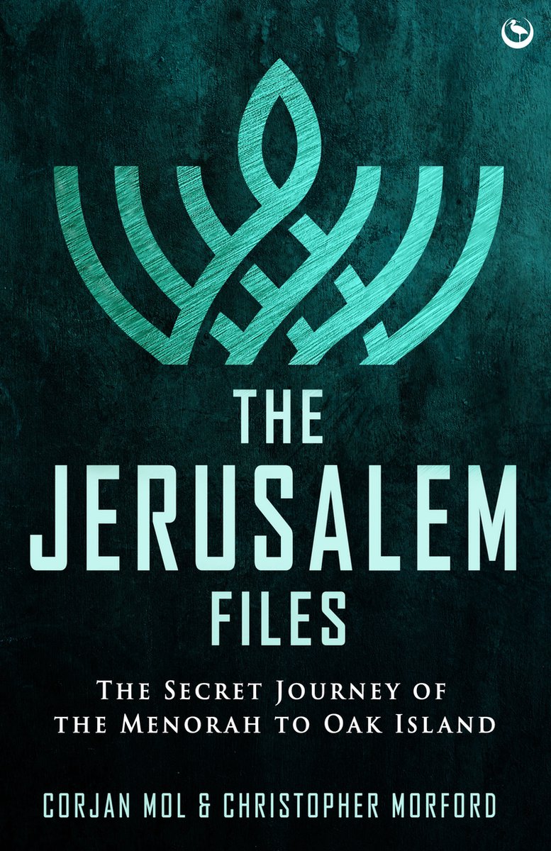
The full research behind the Versailles Alignment is detailed in The Jerusalem Files: The Secret Journey of the Menorah to Oak Island by Corjan Mol and Christopher Morford (Watkins/Penguin Random House).