About This Structure
During Dan Blankenship's excavation of Smith's Cove in 1969-1970, a complex of wooden structures was uncovered inside the cofferdam area. These structures were meticulously documented and multiple samples were submitted for carbon dating, yielding medieval dates that stunned the researchers.
The excavation work began in August 1969 when Blankenship and Gerald Dorey dug with pick and shovel at extreme low tide to expose flood tunnel workings. After finding one tunnel entrance, they extended the search and at the next low tide discovered additional structures approximately 8 feet below the surface.
--- STRUCTURES UNCOVERED ---
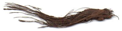
Item #1: An inclined ramp approximately 9' wide and 90' long. The logs forming this ramp were described as "very old" and when followed toward shore, the remains of a higher dock (of much newer construction) were found on top. Rocks 2-3' thick were placed over the lower ramp.
Item #2: A "U"-shaped structure alongside the ramp and just south. The northern side extended over 45' long with a front of about 65'; the southern side over 30' but had been destroyed toward shore. This structure was built primarily from a large spruce log 12-20 inches in diameter, notched with a 6" × 7" spruce timber secured by a 2" thick oak peg. Timbers were spaced about 4'10" on center. Across this log on one end were found 2 timbers lying loose with 2 notches in one end. A sketch was enclosed. Roman numerals are cut into the log at each location. Heavy 2" planks (hardwood) were secured to the bottom of the angle pieces. These timbers were sawn by hand.
Item #3: A neat row of 2" timbers approximately 3' long, in good condition - identified as an attempt at building a dam.
Item #4: A row of 1-3/4' boards laid horizontally and tight together, about 5' high - apparently an attempt to stop water.
Item #5: Two or three horizontal boards laid 6" apart with clay in between - another apparent attempt to stop water.
Item #6: A searchers' shaft only 18" behind Item #5, about 4' wide and 8' long.
Item #7: A piece of metal pipe found about 6' deep below the original beach level, approximately 3" diameter and 14" long.
Item #8: Two pieces of pottery/dish taken from the vicinity of Item #1.
Item #9: A nail dug out of the loose-laying timber on Item #2. (Stelco analysis pending.)
Item #10: A piece of dish and a piece of mug found under the ramp.
Item #11: A wooden box 18" wide and 24" long. The sides are 4" × 6" oak, the bottom is 2" oak, and the ends are 1" spruce. One end of the oak sides is beveled and an oak dowel is in one side only. Found at least 2 feet below the bottom of the large log on the inside corner of Item #2, apparently hidden.
--- CARBON DATING RESULTS ---
• Oak peg from timber structure (sent by McCabe to Geochron, October 1969):
Geochron GX-1692: 1090 ±140 C-14 years BP → A.D. 860 (range 720-1000)
Sample identified as "wood, probably cedar" by Geochron.
• Inclined beam from timber structure (sent by McCabe to Geochron, October 1969):
Geochron GX-1691: 815 ±110 C-14 years BP → A.D. 1135 (range 1025-1245)
Sample identified as "wood, probably pine" by Geochron.
Kerry Ellard's 15 September 1970 letter to Dr. Terasmae confirms: "As far as the samples are concerned, I should point out that they were taken from a wooden structure uncovered below water level in an area which we have recently enclosed with a coffer dam. We think that the timber is spruce and that the peg is oak. The log is almost certainly spruce. Both samples have probably been thoroughly saturated with sea water, since further along the log toward the water, there was considerable damage by sea worms."
The Smith & Coles law firm letter of 14 October 1969 provides additional context: the wood structure was uncovered embedded about 5-6 feet below the seabed, beyond the perimeter of the original coffer dam, generally in line with the so-called cave-in shaft and Money Pit. The wood had been submerged in sea water for 7 years and the find was considered sufficiently significant to warrant testing. Two of the four pieces enclosed were believed to be oak and the other two spruce.
Harold Kruger of Geochron cautioned that both samples gave ages around 1000 years and that the wood fragments came from rather large trees which "may have had a rather substantial age at the time of fabrication." He emphasized that radiocarbon dating measures when the tree formed, not when the wood was worked.
Historical Context
Sources: Les MacPhie, "Summary of Documents and Results for Carbon Dating at Oak Island" (compiled July 2006). Blankenship "Results of digging done in Smith's Cove, November 1969" (pp. 7, 9-10). Blankenship "Summary of Work Performed at Smith's Cove, August 31 - September 18, 1970" (pp. 16-19). Smith & Coles letter to Helix Investments (14 October 1969, p. 11). Ellard to Terasmae (15 September 1970, p. 23). Geochron reports GX-1691, GX-1692 (19 December 1969, pp. 14-15). Kruger to McCabe (19 December 1969, p. 13). Blankenship 'Resume of operations' (14 October 1970, pp. 24, 26-28). Sketch of Item #11 (p. 20). Smith's Cove Grid System map by George Bates, surveyor (p. 18). Structure plan drawings (p. 19).
Where It Was Found
Found at Smith's Cove, inside cofferdam area — the north shore of Oak Island where the flood tunnel system was discovered.